Bergsteiger-/Wandernadel - Hiking and stamp pass - deskline.net
←
→
Transkription von Seiteninhalten
Wenn Ihr Browser die Seite nicht korrekt rendert, bitte, lesen Sie den Inhalt der Seite unten
© Mathäus Gartner
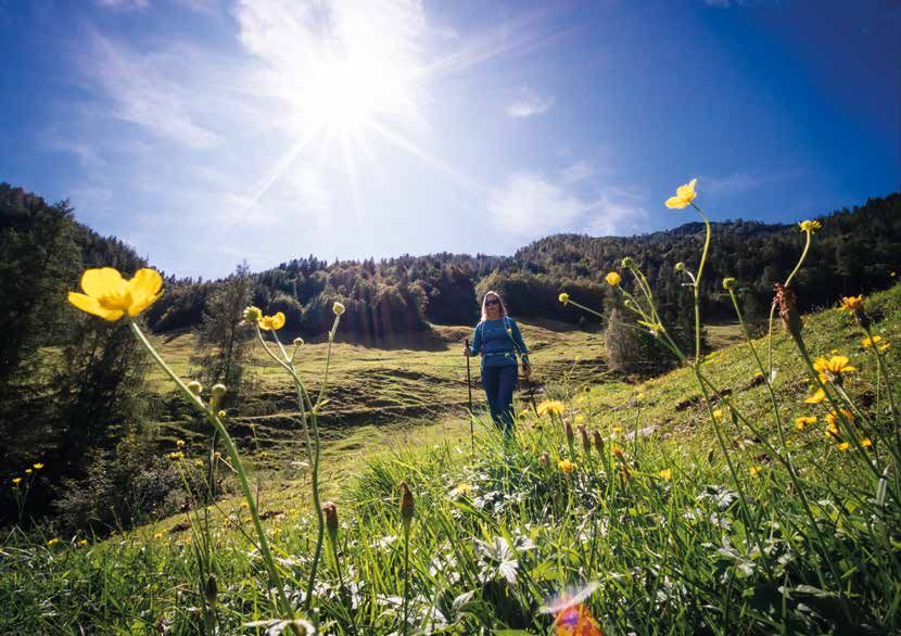
Bergsteiger-/Wandernadel
Hiking and stamp pass
© Mathäus Gartner
                                                                             © defrancesco
 Für Wanderer | For hikers...                                                                  Für Gipfelstürmer | For mountaineers
 Pro aufgesuchter teilnehmender Hütte kann ein Stempel hier im Heft                            Erklimmen Sie die Gipfel des PillerseeTales und holen Sie sich Ihre
 gesammelt werden. Bei 5 Stempeln gibt‘s die Hüttenwandernadel oder                            Wandernadel! Die Wandernadel gibt es in 3-facher Ausführung, je nach
 für Kinder die Tatzi-Nadel!                                                                   erreichter Punktezahl. Für Kinder bis 15 Jahren und Senioren ab 60
                                                                                               Jahren genügt die halbe Punktezahl.
 Collect five stamps and get the hiking pin or the Tatzi pin for children!
                                                                                               The hiking pin is available in three different styles, depending on the
 HINWEIS: Die Öffnungszeiten der Hütten entnehmen Sie bitte der                                number of points. For children up to 15 years and seniors aged 60 and
 aktuellen Ruhetagsliste, welche in den TVB-Infobüros aufliegt!                                over half of the points are necessary.

 ATTENTION: The opening times of the huts can be found on the                                  Die Nadeln erhalten Sie in den Tourimusbüros des PillerseeTales!
 current opening time list, which is available in the tourist offices!                         The pins are available in the tourist offices of the PillerseeTal!

                                                                                             Ab                 Gold           Silber/Silver             Bronze
                                                                                             From          20 Punkte/points    14 Punkte/points       8 Punkte/points
Erhalten am                                                                                  Erhalten am
Received on                                                                                  Received on
Fieberbrunn                                                                                                               Fieberbrunn

                        Burgeralm                                                              Tennalm
                                 1.256 m                                                             1.050 m
                               Fam. Zeller                                                      Andreas Eppensteiner
                                Almen 6                                                         Schönau-Pertrach 14
                           6391 Fieberbrunn                                                        6391 Fieberbrunn
                        Tel.: +43.664.9962708                                        Tel.: +43.664.3886433 | +43.5354.52207
                     E-Mail: burgeralm@gmail.com                                         E-Mail: tennalm-fieberbrunn@aon.at
                                                                                             www.tennalm-fieberbrunn.at
TIPP: Spielberghorn Gipfel (Kontrollstelle) in ca. 2,5 h erwanderbar.   TIPP: Buchensteinwand (Kontrollstelle) in ca. 45 min. erwanderbar.
TIP: Spielberghorn summit (checkpoint) can be hiked in approx. 2.5 h    TIP: Buchensteinwand (checkpoint) can be hiked in approx. 45 min.
*)          *)
Fieberbrunn                                                                                                                                                                     Fieberbrunn
*) Ca. 50 Minuten Fußweg ab der Bergstation | about 50 min. walking time from the mountain station        *) Ca. 20 Minuten Fußweg ab der Bergstation | about 20 min. walking time from the mountain station

                 Wildseeloderhaus                                                                                          Grießenbodenalm
                                          1.854 m                                                                                                   1.400 m
                                   Fam. Kaufmann                                                                                           Johann Grander
                                      Almen 52                                                                                                Almen 44
                                  6391 Fieberbrunn                                                                                        6391 Fieberbrunn
                             Tel.: +43.664.3400717
                                                                                                                                     Tel.: +43.664.9170441
                          E-Mail: info@wildseeloderhaus.at
                             www.wildseeloderhaus.at                                                                              E-Mail: theresia.grander@gmx.at

TIPP: Wildseeloder Gipfel (Kontrollstelle) in ca. 50 min. und Henne Gipfel
(Kontrollstelle) in ca. 40 min. erwanderbar. TIP: Wildseeloder summit (check-
point) can be hiked in approx. 50 min and Henne summit (checkpoint) in
approx. 40 min.
*)
Fieberbrunn                                                                                                                                     Fieberbrunn
*) Ca. 10 Minuten Fußweg ab der Bergstation | about 10 min. walking time from the mountain station

                                 Wildalm                                                                  Pulvermacher Almhütte
                                          1.579 m                                                                            1.020 m
                                 Fam. Sailer                                                                                  Fam. Sturm
                                  Almen 7                                                                                     Almen 13a
                              6391 Fieberbrunn                                                                            6391 Fieberbrunn
                 Tel.: +43.650.4835070 | +43.650.4109830                                                               Tel.: +43.664.4130688
                                                                                                             E-Mail: info@pulvermacher-almhuette.tirol
                                                                                                                www.pulvermacher-almhuette.tirol
*)
Fieberbrunn                                                                                                                             Saalbach
 *) Ca. 15 Minuten Fußweg ab der Mittelstation | about 15 min. walking time from the middle station

                       Wildalpgatterl                                                                  Spielberghaus
                                          1.280 m                                                                  1.311 m
                                 Angela Fürhapter                                                                 Walter Höll
                                      Almen 57                                                               Spielbergweg 207
                                6391 Fieberbrunn                                                                5753 Saalbach
                             Tel.: +43.5354.52655                                                          Tel.: +43.6541.72530
                          E-Mail: office@wildalpgatterl.at                                              E-Mail: info@spielberghaus.at
                              www.wildalpgatterl.at                                                        www.spielberghaus.at
*)
    Fieberbrunn                                                                                                                                        Fieberbrunn
*) Ca. 45 min. Fußweg ab Mittel- oder Bergstation | about 45 min. walking time from the mid or mountain station

                         Lärchfilzhochalm                                                                               Streuböden Alm
                                                   1.363 m                                                                            1.214 m
                                             Fam. Waltl                                                                                 Fam. Thurner
                                             Almen 43                                                                                    Almen 43
                                        6391 Fieberbrunn                                                                             6391 Fieberbrunn
                                   Tel.: +43.664.75085188                                                              Tel.: +43.5354.56013 | +43.664.5100808
                                E-Mail: waltl@laerchfilzhochalm.at                                                           E-Mail: info@streuboeden-alm.at
                                   www.laerchfilzhochalm.at
                                                                                                                                www.streuboeden-alm.at
Fieberbrunn                                                                                         Hochfilzen

      Hochhörndler Hütte                                       Hoametzlhütte
                      1.814 m                                                1.200 m
                      Philipp Raffler                                  Georg Perterer jun.
                        Almen 35                                         Kammbergweg 1
                   6391 Fieberbrunn                                       6395 Hochfilzen
                Tel.: +43.5354.52848                                 Tel.: +43.676.6064415
         E-Mail: info@hochhoerndlerhuette.at                         E-Mail: info@hoametzl.at
            www.hochhoerndlerhuette.at                                   www.hoametzl.at

                                               TIPP: Buchensteinwand (Kontrollstelle) in ca. 50 min. erwanderbar.
                                               TIP: Buchensteinwand (checkpoint) can be hiked in approx. 50 min.
Leogang                                                                              St. Jakob in Haus

          Grießner Seealm                                   Das Weitblick
                     973 m                                               1.456 m
                  Rupert Zehentner                                        Reith 38
                     Grießen 22                                  6392 St. Jakob in Haus
                   5770 Leogang                                  Tel.: +43.676.5409183
             Tel.: +43.664.73453478                       E-Mail: weitblick@pletzer-resorts.com
              E-Mail: seealm@gmx.net                         www.bergbahn-pillersee.com
            seealmleogang.business.site

                                          TIPP: Buchensteinwand (Kontrollstelle) in 5 min. erwanderbar.
                                          TIP: Buchensteinwand (checkpoint) can be hiked in 5 min.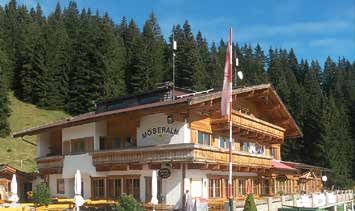
St. Ulrich am Pillersee                                                St. Ulrich am Pillersee

           Schießlingalm                     Jausenstation Grieseltal (Halserbauer)
                       1.271 m                                     950 m

                     Leonhard Foidl                              Josef Burgstaller
              6393 St. Ulrich am Pillersee                        Schwendt 50
               Tel.: +43.650.8225644                        6393 St. Ulrich am Pillersee
               E-Mail: leo.foidl@aon.at             Tel.: +43.5354.88420 | +43.664.4041530
*)
St. Ulrich am Pillersee Waidring
*) Ca. 30 Minuten Fußweg ab der Bergstation | about 30 min. walking time from the mountain station
Winterstelleralm Stallenalm
1.423 m 1.422 m
Anni Waltl Fam. Hagn-Zardini
6393 St. Ulrich am Pillersee 6384 Waidring
Tel.: +43.664.4502841 Tel.: +43.5353.5825
E-Mail: waltlanni62@gmail.com E-Mail: info@stallenalm.at
www.stallenalm.at
TIPP: Wallerberg und Kirchberg (Kontrollstelle) in ca. 1-1,5 h erwanderbar. TIPP: Steinplatte Gipfel (Kontrollstelle) in ca. 1 h 45 min. erwanderbar.
TIP: Wallerberg and Kirchberg (checkpoint) can be hiked in approx. 1-1.5 h TIP: Steinplatte summit (checkpoint) can be hiked in approx. 1 h 45 min.*)
Waidring Waidring
*) Ca. 30 Minuten Fußweg ab der Bergstation | about 30 min. walking time from the mountain station
Möseralm Alpengasthof Oberweißbach
1.440 m 1.000 m
Fam. Weisleitner Familie Kals
6384 Waidring Weissbach 2
Tel.: +43.5353.52473 6384 Waidring
E-Mail: alpengasthof@moeseralm.at Tel.: +43.5353.20053
www.moeseralm.at E-Mail: info@alpengasthof-waidring.tirol
www.alpengasthof-waidring.tirol
TIPP: Rechensaukapelle (Kontrollstelle) in ca. 10 min. erwanderbar.
TIP: Rechensaukapelle (checkpoint) can be hiked in approx. 10 min.Waidring Waidring
Straubingerhaus Panoramarestaurant Kammerkör
1.558 m 1.655 m
Eggenalm 1 Bergstation Steinplatte
6345 Kössen 6384 Waidring
Tel.: +43.5375.6429 Tel.: +43.5353.6316
E-Mail: info@straubingerhaus.at E-Mail: info@kammerkoeralm.at
www.straubingerhaus.at www.kammerkoeralm.at
TIPP: Fellhorn (Kontrollstelle) in ca. 30 min. erwanderbar. TIPP: Steinplatte Gipfel (Kontrollstelle) in ca. 1 h erwanderbar.
TIP: Fellhorn (checkpoint) can be hiked in approx. 30 min. TIP: Steinplatte summit (checkpoint) can be hiked in approx. 1 h© Daniel Gollner
Gehzeit | hiking time                                                                       J                                   Fieberbrunn
        Einkehrmöglichkeit | refreshments

        Schwierigkeit | difficulty:                                                      Aufstieg | ascent: 1:45 h
    # < 200 Höhenmeter: für Einsteiger. Keine Bergwandererfahrung not-                   Abstieg | descent: 1:00 h
        wendig. | < 200 altitude meters: suitable for beginners without prior
        hiking experience.                                                               ## - ###
  ## 200-600 Hm: für Einsteiger. Auf schmäleren Pfaden sollte man sich gut
                                                                                         Wildseeloderhaus, Wildalm
                                                                                                                                                         3
                                                                                                                                                       Punkte/
        bewegen können. | 200-600 altitude meters: suitable for beginners who
                                                                                                                                                        points
        are comfortable on narrow trails.
 ###    600-900 Hm: Für Bergwanderer mit etwas Erfahrung, welche sich auch
                                                                                    Kontrollstelle | checkpoint:
        auf alpinen Bergwegen und Steigen trittsicher bewegen können. Trittsi-
        cherheit und teilweise Schwindelfreiheit erforderlich.                      am Gipfelkreuz /
        | 600-900 altitude meters: suitable for slightly advanced hikers who        at the summit cross
        are comfortable on alpine trails. Trails can have exposed sections that
        require a good head for heights.

#### 900-1.400 Hm: Für erfahrene Bergwanderer, welche ausgesetzte, alpine                                       Henne
        Pfade und Steige mit kurzen drahtseilversicherten Passagen sicher be-
        wältigen können. Trittsicherheit und Schwindelfreiheit erforderlich.
                                                                                                                     2.078 m
        | 900-1.400 altitude meters: for experienced hikers who can safely ne-    Mit der Gondel zum Lärchfilzkogel,     Take the gondola to the Lärchfilz-
        gotiate difficult or rough terrain and exposed sections with handholds/   kurzer Abstieg zu den Wildalmen,       kogel, then further on to the Wildal-
        cables. Prerequisites: sure-footedness and a good head for heights        anschl. Aufstieg zum Wildseelo-        men and up to the Wildseeloder-
                                                                                  derhaus. Von dort führt linkerhand     haus. Take the walking path on
                                                                                  der Weg vom See ansteigend in          the left to the top of the mountain
       Mit dem Rad erreichbar | can be reached by bike
                                                                                  ca. 45 Minuten zum Gipfel.             (about 45 minutes).

                                                                                  TIPP: Verbinden Sie die Wande-         TIP: Walk further on to the „Wild-
       Mit der Gondel bzw. Sessellift erreichbar
                                                                                  rung mit dem „Wildseeloder“ und        seeloder“ and get another 3
       can be reached by gondola resp. chairlift
                                                                                  holen Sie sich weitere 3 Punkte!       points!
       Mit Kinderwagen erreichbar | can be reached with a buggy

       Zu Fuß erreichbar | can be reached on foot
Fieberbrunn C A Fieberbrunn
Aufstieg | ascent: 2:00 h Aufstieg | ascent: 3:30 h
Abstieg | descent: 1:20 h Abstieg | descent: 2:10 h
## - ### ## - ###
Wildseeloderhaus, Wildalm -
Kontrollstelle | checkpoint: Kontrollstelle | checkpoint:
neben dem Gipfelkreuz am Gipfelkreuz
| next to the summit cross | at the summit cross
3
Punkte/
Wildseeloder Karstein
points 2.117 m 1.922 m
Vom Gasthof Auwirt auf dem From Gasthof Auwirt drive along
Von der Bergstation Lärchfilzkogel From the mountain station Lärch- Gebraweg bis zur Abzweigung the Gebraweg to the junction in
zur Wildalm und weiter zum Wild- filzkogel to the Wildalm and further Richtung Hochkogel und auf dem direction Hochkogel and take the
seeloderhaus, rechts am See ent- on to the Wildseeloderhaus. From Fahrweg bis zum Rohrbauern fah- street to the farm house „Rohr“.
lang, den schmalen Weg zur See- the refuge the path leads along the
right side of the lake up to a treeless ren. Weiter auf dem Forstweg bis Continue on the forest road and
wand bis zum Törl, über Scharte zu den oberen Edenhausalmen then further on via the northeast
und Bergrücken bis zum Gipfel. hillside and further along the See-
wand towards the Törl. Through und auf dem Steig zum Karstein. crest to the peak.
the jag and over a soft ridge you
TIPP: Verbinden Sie die Wanderung
mit der Henne und holen Sie sich reach the peak.
TIP: Walk further on to the Henne
5
Punkte/
weitere 3 Punkte!
and get another 3 points! pointsFieberbrunn 9 5 Fieberbrunn
Aufstieg | ascent: 4:00 h Aufstieg | ascent: 5:00 h
Abstieg | descent: 2:40 h Abstieg | descent: 3:30 h
#### ### - ####
Almausschank Pletzer (nur Burgeralm
Automat mit Selbstbedienung)
Kontrollstelle | checkpoint: Kontrollstelle | checkpoint:
5
am Gipfelkreuz am Gipfelkreuz
| at the summit cross | at the summit cross
Punkte/
points
5 Gebra Spielberg
Punkte/ 2.057 m 2.044 m
points
Vom Gh. Eiserne Hand auf dem From the Gasthof Eiserne Hand
linken Weg bis zur Burgeralm. continue further along the path
Ab dem Almausschank Pletzer From the Almausschank Pletzer Weiter in nördlicher Richtung zur on the left to the Burgeralm. Then
taleinwärts bis zur Herrgottsbrü- into the valley to a bridge/path Postmeisteralm und auf dem gut northbound to the Postmeisteralm
cke/Weggabelung. Links weiter zu fork. Take the left pathway to markierten Weg über den Grat and from here along the well mar-
den Farmanger Grundalmen und the Farmanger Grundalmen and zum Gipfel. ked trail to the peak.
weiter zur Gebrakapelle. Von dort further on to the Gebrakapelle.
rechts hinauf zur Gebrascharte From there take the ascent on the
und über den Gebraranken steil right to the Gebrascharte and via
aufwärts zum Gipfel. Gebraranken to the peak.Hochfilzen 7 G Hochfilzen
Aufstieg | ascent: 2:45 h Aufstieg | ascent: 1:15 h
Abstieg | descent: 2:00 h Abstieg | descent: 1:00 h
### # - ##
-
Tour Rast (Ausgangspunkt)
Kontrollstelle | checkpoint: Kontrollstelle/checkpoint:
am Gipfelkreuz am Weg Nähe Liedlalm
| at the summit cross | on the walking path
next to the Liedlalm
4 Kirchl Liedlalm
Punkte/ 1.693 m 1.168 m
points
Ausgehend von der Grießkapelle Start from the „ Grießkapelle“ on
In Oberwarming / Tour Rast nach From Oberwarming / Tour Rast rechtsufrig bergaufwärts etwas the right bank slightly rising to the
der Brücke rechts ca. 300 m bach- cross the bridge, turn right and fol- ansteigend zur Liedlalm (nicht be- Liedlalm (not opened).
aufwärts dem Forstweg folgen, bei low the forest road approx. 300 m. wirtschaftet).
der ersten Weggabelung links hal- Turn left at the first crossing and
ten und nach dem ersten kurzen after the first ascent turn right. Fol-
Anstieg rechts querfeldein dem low the hiking path to the peak.
Wanderweg folgen. Der letzte
Abschnitt erfolgt steil zum Gipfel.
2
Punkte/
pointsSt. Jakob in Haus 8 2 St. Jakob in Haus
Aufstieg | ascent: 0:25 h Aufstieg | ascent: 2:00 h
Abstieg | descent: 0:25 h Abstieg | descent: 1:30 h
# ##
- -
Kontrollstelle/checkpoint: Kontrollstelle/checkpoint:
Wegweiser am Rundweg am Wegweiser vor der Alm
| signpost at the circular trail | at the signpost in front of
the hut
1 Kühle Klause Schartenalm
Punkt/ 920 m 1.330 m
point
Beim Bauernhof Lehrberg (Nähe Pass the Lehrberg farm (near
Vom Dorfzentrum auf den Rund- From the village centre on the Bushaltestelle) vorbei, gerade- the bus stop), follow the signpost
weg Buchensteinwand in Rich- circular trail „Buchensteinwand“ aus dem Wegweiser bis zur Lehr- straight ahead to the Lehrbergalm
tung Mühlau bis zur Kühlen Klause in direction of Mühlau up to Kühle bergalm folgen und weiter bis zur and continue to the Schartenalm.
und über das Familienland retour Klause and back via Familienland Schartenalm.
zum Zentrum. to the centre.
2
Punkte/
pointsSt. Jakob in Haus 1 N St. Ulrich am Pillersee
1:30-2:00 h Aufstieg | ascent: 0:20 h
Abstieg | descent: 0:15 h
##
#
Das Weitblick, Tennalm,
Hoametzlhütte Gh. Adolari
Kontrollstelle/checkpoint: Kontrollstelle/checkpoint:
am Wegweiser neben Alpen- an der Abzweigung (Weg-
gasthof | at the signpost near weiser) zur Klamm | at the
to the Alpengasthof signpost next to the gorge
2
Punkte/
Buchensteinwand Teufelsklamm
points 1.456 m 950 m
St. Jakob in Haus: Vom Dorfzen- St. Jakob in Haus: From the center Vom Parkplatz Teufelsklamm Possibility to park directly in front
trum über Filzen und Mühlau links to Filzen and Mühlau and through (Bienenlehrpfad, gebühren- of the Teufelsklamm (chargeable).
durch den Wald hoch zum Gipfel. the woods up to the peak. St. Ul- pflichtig) dem Weg steil folgend From here follow the sign-posts
St. Ulrich am Pillersee: Vom Orts- rich am Pillersee: From Flecken bis zur Abzweigung in die Teu- „Teufelsklamm“ to the foot-path
teil Flecken den Forstweg hoch zur to the Kammbergalm and up to
Kammbergalm und weiter zum Gip- the peak. Hochfilzen: From the felsklamm (linkerhand). into the gorge.
fel. Hochfilzen: Vom Liftparkplatz parking at the liftstation take
Richtung Obertenn, nach der Weg- the left path up to Hoametzl and
kreuzung links auf dem Wanderweg further on to the peak. Fieber-
zur Hoametzlhütte und weiter zum
Gipfel. Fieberbrunn: Vom Dorfzen-
brunn: From the center up to
the Tennalm and on alpine meadows 1
Punkt/
trum hoch Richtung Tennalm und further on to the peak.
point
über Almweiden weiter zum Gipfel.St. Ulrich am Pillersee T K St. Ulrich am Pillersee
Aufstieg | ascent: 2:30 h
Abstieg | descent: 2:00 h
Aufstieg | ascent: 2:50 h
Abstieg | descent: 2:30 h
5
Punkte/
points
## - ### ### - ####
Winterstelleralm -
Kontrollstelle/checkpoint: Kontrollstelle/checkpoint:
am Gipfelkreuz am Gipfelkreuz /
| at the summit cross at the summit cross
4
Punkte/
Wallerberg Kirchberg
points 1.682 m 1.678 m
Ausgehend vom Dorfzentrum Rich- Starting from the village centre in
Ausgehend vom Dorfzentrum Rich- From the center to the Latschen- tung MACK Latschenölbrennerei the direction of the MACK mountain
tung Latschenbad. Ab hier linker- bad. Take the left walking path to und über die „Steinerne Stiege“ pine oil distillery and via „Steiner-
hand Richtung Lindtalalm, weiter the Lindtalalm, further on to the hoch zum Gipfel des Kirchbergs. ne Stiege“ up to the summit of the
hoch zur Winterstelleralm und zum Winterstelleralm and up to the Retour über den Schafelberg und Kirchberg. Back via Schafelberg and
Wallerberg. Wallerberg. die Teufelspalfen zum Latschen- the „Teufelspalfen“ to the Latschen-
bad und weiter ins Dorfzentrum. bad and to the village centre. You
TIPP: Verbinden Sie die Wanderung TIP: Walk further on to the Kirch- Kondition, Trittsicherheit sowie need to be fit, sure-footed and have
mit dem „Kirchberg“ und holen Sie berg and get another 5 points! Schwindelfreiheit erforderlich! a head for heights!
TIPP: Verbinden Sie die Wanderung TIP: Walk further on to the Waller-
sich weitere 5 Punkte! berg and get another 4 points!
mit dem „Wallerberg“ und holen Sie
sich weitere 4 Punkte!St. Ulrich am Pillersee/Waidring F H Waidring
0:30 - 1:00 h Aufstieg | ascent: 2:25 h
Abstieg | descent: 1:00 h
# - ##
## - ###
Gh. Oberweißbach,
Gh. Adolari Panoramarestaurant
Kammerkör, Stallenalm
Kontrollstelle/checkpoint:
links neben der Kapelle Kontrollstelle/checkpoint:
| on the left side of the chapel am Gipfelkreuz
| at the summit cross
2
Punkte/
Rechensaukapelle Steinplattengipfel
points 1.000 m 1.869 m
Waidring: Ausgangspunkt Park- Waidring: starting point parking Von der Bergstation Steinplatte From the top station of the Stein-
platz Weißbach 1.) auf dem Forst- lot Weißbach 1) follow the walking zur Stallenalm und weiter Rich- platte cable car follow the road
weg (rechts) den Bach entlang in path on the right, after about 3 km tung Grünwaldalm. Über den down to the Stallenalm and further
die Schlucht, nach ca. 3 km links turn left to Gasthof Oberweißbach Wieslochsteig (Trittsicherheit!) on in direction of Grünwaldalm.
Richtung Gh. Oberweißbach oder 2) take the walking path on the und durch felsiges Gelände hoch Via Wieslochsteig and through
2.) links über die asphaltierte Stra- left up to the Gasthof Ober- zum Steinplattengipfel. Zurück rocky terrain up to the peak. Back
ße bis zum Gh. Oberweißbach. Am weißbach, further on to the Re- über eine breite Schotterstraße via a wide gravel road to the top
Gasthof vorbei und bergauf zur chensaukapelle. St. Ulrich am zur Bergstation. station.
Rechensaukapelle. St. Ulrich a.P.:
hinter dem Gasthof Adolari bergan
Pillersee: from Gasthof Adolari up
to the Rechensauhöfe and further 2
in Richtung Rechensauhöfe, daran on to the chapel. Punkte/
vorbei zur Rechensaukapelle. pointsWaidring D Z Waidring
3
Aufstieg | ascent: 0:30 h Gehzeit gesamt: 5:30 h
Abstieg | descent: 0:30 h Abstieg | descent: 2:45 h
Punkte/
points
# - ## ##
- Gh. Adolari
Kontrollstelle/checkpoint:
Kontrollstelle/checkpoint: am Wegweister hinter der
am Gipfelkreuz | Kitzgrabenhütte
at the summit cross | at the signpost behind the
„Kitzgrabenhütte“
2 Windbühel Panoramaweg
Punkte/ 1.513 m 1.181 m
points
Vom Parkplatz Aschertal (Ortsteil From the Aschertal parking (dis-
Strub) bis zur Abzweigung Griess- trict Strub) to the Griessbach-
Vom Höhenparkplatz Steinplatte From the Steinplatte parking bachsteig und rechts weiter bis zur steig and further on to the Kitz-
(Auffahrt über die Mautstraße) (ascent via toll road) take the na- Kitzgrabenhütte. Hier dem linken grabenhütte. Follow the path
linkerhand über den Naturlehrpfad ture trail on the left in direction of Weg folgend wieder talwärts durch on the left downhill through the
in Richtung Durchkaseralmen und Durchkaseralmen and then further die Teufelsklamm zum Parkplatz Teufelsklamm to the parking lot.
dann weiter auf den Windbühel. on to the Windbühel. Bienenlehrpfad. Retour rechts der Continue to the right and take
Straße über Peiting/Schöttlbauer the street to Peiting/Schöttlbauer,
und weiter zur Schäferaukapelle. Schäferaukapelle, further on to
Dem schattigen Weg entlang zur the Kneippanlage and back to the
Kneippanlage und zum Ausgangs- starting point.
punkt.Waidring 3
Aufstieg | ascent: 2:30 h
Abstieg | descent: 2:00 h
##
Straubinger Haus
Kontrollstelle/checkpoint:
am Gipfelkreuz |
at the summit cross
Fellhorn
1.764 m
Vom Bergparkplatz Steinplatte From the Steinplatte parking
(Auffahrt über die Mautstraße) (ascent via toll road) take the na-
über den Naturlehrpfad in Richtung ture trail to the Durchkaseralm and
© OFP Kommunikation
Durchkaseralmen, Windbühel. Windbühel. From there take the
Von hier auf dem linken Weg zum trail on the left to the Straubinger
Straubinger Haus (1.558 m) und Haus (1.558 m) and further on
weiter zum Fellhorn. to the Fellhorn.
5
Punkte/
pointsTourismusverband PillerseeTal - Kitzbüheler Alpen
Dorfplatz 1 | 6391 Fieberbrunn
Tel.: +43.5354.56304
E-Mail: info@pillerseetal.at
www.pillerseetal.at
Ausarbeitung und Inhalt | contents: Tourismusverband PillerseeTal
Bilder | images: Archiv TVB PillerseeTal, defrancesco, Helmut Lackner, Anita Heigl,
Petra Astner, Christof Willms, Bergbahn Pillersee, div. Hütten
August 2021 | Änderungen vorbehalten | Subject to change!
maps.pillerseetal.atSie können auch lesen