Aktiv Wellness - Zillertal ARENA
←
→
Transkription von Seiteninhalten
Wenn Ihr Browser die Seite nicht korrekt rendert, bitte, lesen Sie den Inhalt der Seite unten
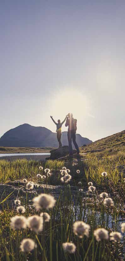
27.06. - 24.09.2021
SOMMERPROGRAMM 2021

     Aktiv
    Wellness

                      Zell-Gerlos
                      600m   1.300m

GERLOS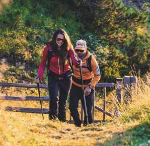
2-3

                                                                                                                                                                      PROGRAMM SOMMER 2021 · Program summer 2021
                                                                                           MONTAG		NORDIC WALKING
       Programm 2021 Program 2021                                                          Monday		Treffpunkt: 16.30 Uhr Musikpavillon
                                                                                                   Erlernen Sie Nordic Walking, das dynamische Gehen mit
      Erleben Sie aktive Erholung, Ruhe und Besinnung in der wunderschönen                         speziellen Carbonstöcken, mit unserem ausgebildeten
      Bergnatur in der Zillertal Arena. Fördern Sie Ihre Gesundheit und Ihr Wohlbefinden           Nordic Walking Trainer. Diese Bewegungsform bietet
      mit sanften Wanderungen und leichten Gesundheits- und Entspannungsübungen.                   ein sanftes Ganzkörpertraining. Auch für Einsteiger ideal
      Das aktiv Wellness Programm steht allen Gästen aus Zell-Gerlos von 27. Juni bis              geeignet. Lauf- oder Trekkingschuhe von Vorteil. Dauer: ca
      24. September 2021 gegen Vorlage des ArenaSchecks kostenlos zur Verfügung!                   1,5 Std. (Unkostenbeitrag für Stöcke € 3,00).
                                                                                           		      Meeting point: 4.30 p.m. music pavilion
      Experience active relaxation, calmness and consciousness in the beautiful moun-              Get to know this dynamic way of walking with our qualified
      tain nature of the Zillertal Arena. Boost your health and wellbeing with gentle              Nordic walking guide. Because you use specially designed
      hikes and easy health and relaxation exercises. The „aktiv Wellness“ program                 carbon poles, you also work your upper body so it is a
      is available for all guests from 27th of June to 24th of September 2021 against              complete body workout. This activity is also suited for
      presentation of the „ArenaScheck“ free of charge.                                            beginners. Running or light hiking shoes are recommen-
                                                                                                   ded. Duration: approx. 1.5 hours (rental charge carbon
      SONNTAG		 EINSTIMMUNGSWANDERUNG INS SCHÖNACHTAL                                              poles: € 3,00).
      Sunday 		 Hike in the „Schönach“ valley
      		        Treffpunkt: 10.00 Uhr Musikpavillon
                                                                                            FACKELWANDERUNG Torchlight hike
      		LEICHT  Schöne, leichte Wanderung in herrlicher Natur ins Schönachtal.              Treffpunkt: 21.00 Uhr Musikpavillon

                Nach einem Einkehrschwung spazieren wir in gemütlichem                      Lichter in der Nacht - sobald es in Gerlos dunkel geworden
                Tempo zurück nach Gerlos. Sie erhalten interessante Wandertipps             ist, marschieren wir mit unseren Fackeln durch die Nacht!
                und einen Einblick in die zahlreichen Wandermöglichkeiten in                Achtung: Bei Schlechtwetter entfällt die Veranstaltung!
                Gerlos. Gesamtdauer: ca. 4 Std., Gehzeit ca. 2,5 Std.                       Meeting point: 9.00 p.m. music pavilion

      		        Meeting point: 10.00 a.m. music pavilion                                    Lights in the night - as soon as it gets dark in Gerlos, we
      		        Gentle hike through wonderful nature in the “Schönach” valley.              march with our torches through the night! Attention: In
                After a stop-over we walk back to Gerlos in a comfortable pace.             case of bad weather the event will becancelled!
                You get interesting hiking tips and an insight in the numerous
                hiking possibilities around Gerlos. Total duration: approx. 4 hours,       DIENSTAG		 WANDERUNG ZUM ISSKOGEL Hiking tour Isskogel
                walking time: approx. 2.5 hours                                            Tuesday		Treffpunkt: 10.00 Uhr Musikpavillon
                                                                                           		Wir fahren mit der Isskogel-Bahn (Unkostenbeitrag
      		 RÜCKENFIT Back Exercises                                                           MITTEL    Bergfahrt € 11,00 bzw. Berg-/Talfahrt € 16,00) zum Isskogel
      		 Treffpunkt: 16.30 Uhr Musikpavillon                                                          Restaurant (1.900 m). Nach einer kleinen Warm Up-Einheit
      		 Durch spezielle Mobilisations- und Kräftigungsübungen stärken                                wandern wir zum Isskogel-Gipfel (2.264 m) und von dort
         wir unseren Rücken, verbessern die Beweglichkeit und erlan-                                  retour zur Latschenalm. Gesamtdauer: ca. 5 Std., Gehzeit: ca.
         gen so ein angenehmes Wohlbefinden. Dauer: ca. 1 Std. (Bitte                                 3 Std., Aufstieg ca. 350 Höhenmeter. Wichtig: gutes
         Handtuch mitnehmen).                                                                         Schuhwerk (Berg- oder Trekkingschuhe)!
      		 Meeting point: 4.30 p.m. music pavilion                                                      Meeting point: 10.00 a.m. music pavilion
      		With special mobilization and strengthening exercises we                           		         Ascent with the cable car „Isskogel“ (costs: ascent € 11,00
         strengthen our back, improve our mobility and so we reach a                                  or ascent and descent € 16,00) to the Isskogel Restaurant
         pleasant well-being. Duration: approx. 1 hour (please bring a                                (1,900m). After a small warm up we walk to the Isskogel
         towel).                                                                                      summit (2.264m) and from there back to the Latschenalm.
                                                                                                      Total duration: approx. 5 hours, walking time: approx.
                                                                                                      3 hours, Ascent: approx. 350 altitude. Important: good
                                                                                                      footwear (hiking boots or trekking shoes)!

                                                                                           		         BOGENSCHIESSEN archery
                                                                                                      Treffpunkt: 15.30 Uhr Musikpavillon
                                                                                           		         Nach einer Unterweisung unseres geschulten Mitarbeiters
                                                                                                      geht es anschließend auf dem 3D Bogenparcours im Wald
                                                                                                      mit Pfeil und Bogen auf die Jagd.
                                                                                           		         Meeting point: 3.30 p.m. music pavilion
                                                                                           		 After a briefing by our trained employee, you can then go
                                                                                                      hunting with a bow and arrow on the 3D archery course in
                                                                                                      the forest.

                                                                          Unser
                                                                     Wochenprogramm
                                                                         ist mit
                                                                       ArenaScheck
                                                                        kostenlos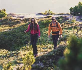
4-5

                                                                                                                                                           PROGRAMM SOMMER 2021 · Program summer 2021
      MITTWOCH    BESINNLICHE SONNENAUFGANGSTOUR                                     DONNERSTAG FAMILY BIKE TOUR MIT TECHNIKTRAINING
      Wednesday   Beautiful Sunrise Tour                                             Thursday		(WILDGERLOSTAL)
                  Treffpunkt: 5.30 Uhr Musikpavillon (nur bei klarem Himmel)         		         Family bike tour with technique training (Wildgerlostal)
       LEICHT     Erleben Sie die ersten Sonnenstrahlen und das sagenhafte                      Treffpunkt: 10.00 Uhr Musikpavillon
                  Morgenerwachen am Berg mit herrlichem Ausblick von der                        Die Strecke rund um den Durlassboden Stausee bietet
                  Gerlosplatte. Rückkehr nach Gerlos ca. 8.00 Uhr, Gesamtdauer:       E-        ein hervorragendes Bikeerlebnis für die ganze Familie.
                  ca. 2,5 Std., Gehzeit: ca. 1,5 Std.                                		         Meeting point: 10.00 a.m. music pavilion
                  Wichtig: Bitte mit eigenem PKW zum Treffpunkt kommen!                         The route around the Durlassboden reservoir offers an
                  Meeting point: 5.30 a.m. music pavillon (only with a clear sky)               excellent bike experience for the whole family.
                  Enjoy the first sun rays and the wonderful awakening of the day
                  on the mountain with the beautiful view from the „Gerlosplatte“.    GERLOSER BAUERNMARKT

                  Return to Gerlos at approx. 8.00 am, walking time: approx. 1.5
                                                                                      Farmer‘s Market in Gerlos
                  hours. Important: Please come with your own car to the              Treffpunkt: 16.00 Uhr Musikpavillon
                  meeting point!                                                      Wöchentlich ab 24. Juni findet immer donnerstags der
                                                                                      Gerloser Bauernmarkt statt. Vom frischen Brot, Butter,
                  TRISSLALM                                                           verschiedene Wurstsorten bis hin zum selbsgebrann-
       LEICHT     Treffpunkt: 10.00 Uhr Musikpavillon                                 ten Zillertaler Bauernobstler können Sie alles vor Ort
                  Wir fahren mit dem eigenen PKW (Parkgebühr € 5,00) bis              erwerben.
                  zum Alpengasthof Finkau. Von dort wandern wir über die              Meeting point: 4.30 p.m. music pavilion
                  Leitenkammer-Klamm zur Trisslalm. Der Rückweg führt uns an          Visit the weekly Farmer‘s Market in Gerlos from 24th
                  der Finkau Kapelle beim Finkau-See vorbei. Gesamtdauer: ca.         of June weekly. You have the chance to buy everything
                  4 Std.; Gehzeit: ca. 2,5 Std; Wichtig: Bitte mit eigenem PKW        from freshly baked bread, different kinds of sausages
                  zum Treffpunkt kommen!                                              to homemade Zillertaler farmer‘s fruit brandy.
                  Meeting point: 10.00 a.m. music pavilion
                  We drive with the own car into the valley „Wildgerlostal“ to       		 BESICHTIGUNG FERNHEIZWERK
                  the restaurant „Finkau“ (park fee: € 5,00). From there we hike     		 Sightseeing district heating station
                  through the „Leitenkammer-Klamm“ to the „Trisslalm“. The              Treffpunkt: 16.30 Uhr Musikpavillon
                  way back leads us to the chapel „Finkau“ past the „Finkau“            Wandern Sie mit uns zum Fernheizwerk und lernen Sie
                  lake. Total duration: approx. 4 hours, walking time: approx.          die Vorteile und Nachhaltigkeit kennen. Gesamtdauer:
                  2.5 hours. Important: Please come with your own car to the            ca. 1 Std., Gehzeit ca. 15 min.
                  meeting point!                                                        Meeting point: 4.30 p.m. music pavilion
                                                                                        We hike to the district heating station and learn the
                  LEICHTER LAUFEN Run easier                                            benefits and sustainability of this station.Total dura-
                  Treffpunkt: 16.30 Uhr Musikpavillon                                   tion: approx. 1 hour, walking time: approx. 15 min.
                  Nach einer kleinen Technikeinführung laufen wir die 7,4 km
                  lange Bachrunde und entdecken dabei, wie leicht und erlebnis-      FREITAG		WANDERUNG ZUM ASTACHHOF Hike to the Astachhof
                  reich Laufen sein kann. Dauer ca. 1 Std.                           Friday   Treffpunkt: 10.00 Uhr Musikpavillon
                  Wichtig: Laufschuhe und Kondition!                                          Mit dem Wanderbus bis zum Eingang des
                  Meeting point: 4.30 p.m. music pavilion                                     Schwarzachtales. Von dort führt die Wanderung
                  After a little technical introduction, we jog the 7.4 km long        MITTEL Richtung Böndl zum Astachhof (1.320m). Nach einer
                  creek loop and discover how easy and exciting running can be.               Stärkung wandern wir über das Grasegg zurück nach
                  Duration approx. 1 hour.                                                    Gerlos-Gmünd. Gesamtdauer: ca. 5 Std. Gehzeit: 3,5
                  Important: running shoes and fitness!                                       Std. Wichtig: gutes Schuhwerk (Bergschuhe)!
                                                                                              Meeting point: 10.00 a.m. music pavilion
                  PLATZKONZERT DER BMK GERLOS                                                 We take the free hiking bus to the entrance of the
                  Place concert of the BMK Gerlos                                             “Schwarzach” valley. From there the hike leads in
                  Treffpunkt: 20.15 Uhr Musikpavillon                                         the direction of Böndl to the Astachhof (1.320m). After
                  Ab Anfang September, Beginn um 20.00 Uhr                                    refreshment, we hike back to Gerlos-Gmünd via the
                  Dauer: ca. 1 Std.                                                           Grasegg. Total duration: approx. 5 hours, walking
                  Meeting point: 8.15 p.m. Music pavilion                                     time: approx. 3.5 hours. Important: good footwear
                  Starting at the beginning of September at 8.00 p.m.                         (hiking boots)!
                  Duration: approx. 1 hours

         TREFFPUNKT FÜR ALLE AKTIVITÄTEN: MUSIKPAVILLON GERLOS -
                     KEINE ANMELDUNG ERFORDERLICH!

         MEETING POINT FOR ALL AKTIVITIES: MUSIC PAVILION GERLOS -
                     NO PRE-REGISTRATION NECESSARY!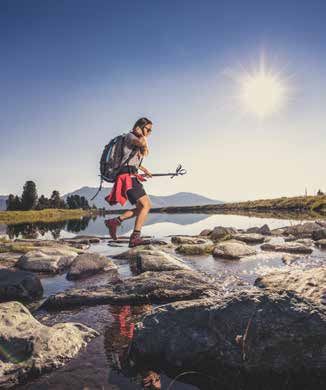
6-7

                                                                                                                                                                              LAUF- UND NORDIC WALKING TRAILS · Running and nordic walking trails
       Lauf- & Nordic Walking Trails
       Running & nordic walking trails                                                   Blauer Richtungspfeil + Piktogramme = LEICHT
                                                                                         Leichte Lauf- und Nordic Walkingstrecken, die vorwiegend flach verlaufen und vor
      52 KILOMETER, 7 STRECKEN, 2 AUSGANGSPUNKTE                                         allem für Einsteiger und leicht Fortgeschrittene geeignet sind.
      52 kilometres, 7 tracks, 2 starting points                                         Blue direction arrow + icons = EASY
      Ob Jogging, Running, Alpine-Running, Walking oder Nordic-Walking, die land-        Easy running and Nordic walking routes, that run mostly flat and for beginners and
      schaftliche Vielfalt und Schönheit rund um Gerlos bietet immer ein nachhaltiges    light advanced users suitable.
      Naturerlebnis. In unserer Lauf- und Nordic Walking-Region finden sich erlebnis-
      orientierte Trails für den Sportler genauso wie ideal geeignete Strecken für den
      Neueinsteiger.

      Nordic Walking
      # ist ein effektives und sanftes Ganzkörpertraining
      # entlastet die Wirbelsäule und Gelenke                                            Roter Richtungspfeil + Piktogramme = MITTEL
      # stärkt Herz und Kreislauf                                                        Mittelschwere Strecken, die sich vor allem an fortgeschrittene und leistungsorien-
      # löst Muskelverspannungen im Nacken- und Schulterbereich                          tierte Läufer und Nordic Walker richten.
      # kräftigt die Schulter-, Arm- und Brustmuskulatur                                 Red direction arrow + icons = MODERATE
      # verbessert die Sauerstoffaufnahme                                                Moderate routes, which are aimed primarily at advanced and performance-
      # wirkt sich positiv auf Blutdruck, Cholesterin und Körperfett aus                 oriented runners and Nordic walkers.
      # ist leicht und schnell erlernbar und macht einfach Spaß!

      Whether jogging, running, alpine running, walking or nordic walking, the natural
      diversity and beauty around Gerlos offers a lasting nature experience. In our
      running and nordic walking region can be found adventure trails for athletes as
      well as ideally suitable routes for beginners.                                     Schwarzer Richtungspfeil + Piktogramme = SCHWER
                                                                                         Anspruchsvolle Strecken, vor allem für fortgeschrittene und leistungsorien-
      Nordic Walking                                                                     tierte Läufer und Nordic Walker mit entsprechenden Ansprüchen an ihre
      # is an effective and gentle full body workout                                     Trainingsstrecken.
      # relieves the spine and joints                                                    Black direction arrow + icons = HARD
      # strengthens the heart and circulation                                            Demanding routes, which are aimed primarily at advanced and performance-
      # relieves muscle tension in the neck and shoulder area                            oriented runners and Nordic walkers with appropriate demands on their training
      # improves oxygen uptake                                                           tracks.
      # has a positive effect on blood pressure, cholesterol and body fat
      # is easy to learn and great fun!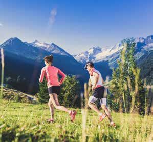
8-9

                                                                          LAUF- UND NORDIC WALKING TRAILS · Running and nordic walking trails
       Überblick Trails Gerlos Overview Gerlos trails

      Route 1   GMÜNDER SEEMEILE nautical mile Gmünd
                Ausgangspunkt: Hotel Kröller
                Starting point: Hotel Kröller
                Länge Length: 4,9 km

      Route 2   DORFRUNDE village run
                Ausgangspunkt: Spielplatz „Bärlihöhle“
                Starting point: playground „Bärlihöhle“
                Länge Length: 1,5 km

      Route 3   INNERTAL-RUNDE run „Innertal“
                Ausgangspunkt: Spielplatz „Bärlihöhle“
                Starting point: playground „Bärlihöhle“
                Länge Length: 7,1 km

      Route 4   BACHRUNDE run at the creek
                Ausgangspunkt: Spielplatz „Bärlihöhle“
                Starting point: playground „Bärlihöhle“
                Länge Length: 7,4 km

      Route 5   WASSERFALL-TRAIL waterfall trail
                Ausgangspunkt: Spielplatz „Bärlihöhle“
                Starting point: playground „Bärlihöhle“
                Länge Length: 7,7 km

                Ausgangspunkt starting point
                                                                      3

                                                                  2

                                                              4

                                                          5
          1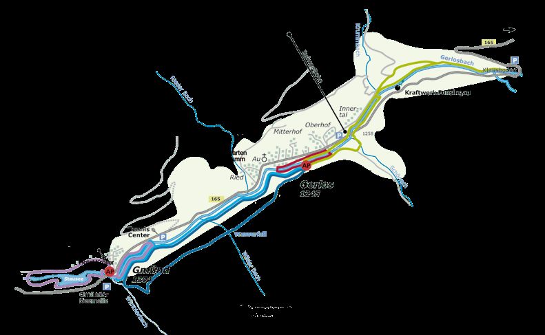
10 - 11

                                                                                                                                                                            LAUF- UND NORDIC WALKING TRAILS · Running and nordic walking trails
    1 GMÜNDER SEEMEILE 4,9 km                                                                3 INNERTAL-RUNDE 7,1 km
          Nautical mile Gmünd                                                                   Run „Innertal“
                59 hm               30%          7%          1.223 m                                 100 hm               10%          1,3%       1.345 m
                12 hm/km            25 hm                    1.190 m                                 14 hm/km             60 hm                   1.249 m

              Kurzcharakter          flach verlaufende Strecke			                                   Kurzcharakter          leichte anspruchsvolle Strecke
              General information    flat running route                                             General information    easy demanding route
              Weg                    Schotterwege, Wald- und Wiesenwege                             Weg                    Schotterwege, Wald- und Wiesenwege
              Way                    gravel, forest and meadow paths                                Way                    gravel, forest and meadow paths
              Ausgangspunkt          Gerlos Gmünd (Hotel Kröller)                                   Ausgangspunkt          Spielplatz „Bärlihöhle“
              Starting point         Gerlos Gmünd (Hotel Kröller)                                   Starting point         playground „Bärlihöhle“
              Höhenprofil                                                                           Höhenprofil
              elevation profile                                                                     elevation profile

                                                                                                Vom Spielplatz „Bärlihöhle“ nach Osten am Gerlosbach entlang. Dem
          Vom Startpunkt am Stausee entlang, durch den Tunnel und über die                      Weg folgend Richtung Durlassboden Stausee erreicht man über den
          Staumauer. Über einen kurzen, steilen Anstieg zum „Graseggweg“, am „Hotel             Waldweg den Wendepunkt „Klausboden“ vor der Dammkrone des
          Almhof“ vorbei hinunter zur Bundesstraße. Die Straße queren, am Bach entlang          Speichersees. Zurück meist ein ähnlicher Streckenverlauf.
          bis zum Tenniscenter und auf der anderen Bachseite zurück zum Start.                  From the playground „Bärlihöhle“ to the east along the creek
          From the starting point along the lake through the tunnel and over the dam.           „Gerlosbach“. Following the path towards Durlassboden Reservoir, says
          Over a short, steep climb to the „Graseggweg“, past the „Hotel Almhof“ down           the turning point „Klausboden“ in front of the dam crest of the reservoir
          to the main road. Cross the road, along the creek to the tennis center and on         via the forest path. Back mostly a similar route.
          the other side of the creek back to the start.
                                                                                                INFORMATION
                                                                                                   Summe der zurückgelegten Höhenmeter
                                                                                                   total meters of altitude
   2 DORFRUNDE 1,5 km                                                                              durchschnittlich zurückgelegte Höhenmeter pro Kilometer
          Village run                                                                              average distance in meters of altitude per kilometres
                9 hm                2%           0,5%        1.252 m                               maximale Steigung in Prozent
                                                                                                   maximum acclivity in percent
                6 hm/km             5 hm                     1.244 m                               längste durchgehende Steigung in Höhenmeter
                                                                                                   longest continuous acclivity in meters of altitude
              Kurzcharakter          flach verlaufende Strecke			                                  durchschnittliche Steigung in Prozent
              General information    flat running route                                            average acclivity in percent
              Weg                    Schotter- und Asphaltwege                                     Höchster Punkt
              Way                    gravel and asphalt paths                                      highest point
              Ausgangspunkt          Spielplatz „Bärlihöhle“                                       Niedrigster Punkt
              Starting point         playground „Bärlihöhle“                                       lowest point
              Höhenprofil
              elevation profile

          Vom Spielplatz „Bärlihöhle“ nach Osten immer am Gerlosbach entlang. Über
          die erste Brücke und sofort wieder entlang des Baches Richtung Westen bis
          zur Brücke (Hotel Garni Alpenrose). Wieder auf die andere Bachseite wechseln
          und zurück zum Start. Diese Strecke ist als Anfängerstrecke und auch als
          Tempolaufstrecke geeignet.
          From the playground „Bärlihöhle“ to the east always along the creek
          „Gerlosbach“. Cross the first bridge and then right away again along the creek
          westwards to the bridge (Hotel Garni Alpenrose). Switch back to the other side
          of the creek and back to the start. This route is suitable as a beginners course
          and as a tempo running track.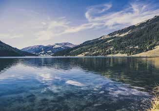
12 - 13

                                                                                                                                                                                 LAUF- UND NORDIC WALKING TRAILS · Running and nordic walking trails
   4 BACHRUNDE 7,4 km                                                                        5 WASSERFALL-TRAIL 7,7 km
          Run at the creek                                                                      Waterfall trail
               94 hm                14%          0,7%        1.255 m                                  237 hm              20%             1,9%        1.350 m
               13 hm/km             32 hm                    1.203 m                                  31 hm/km            48 hm                       1.203 m

              Kurzcharakter          mittelschwere verlaufende Strecke			                           Kurzcharakter           anspruchsvolle Strecke
              General information    middle running route                                           General information     demanding running route
              Weg                    Schotterwege, Wald- und Wiesenwege                             Weg                     Schotterwege, Wald- und Wiesenwege
              Way                    gravel, forest and meadow paths                                Way                     gravel, forest and meadow paths
              Ausgangspunkt          Spielplatz „Bärlihöhle“                                        Ausgangspunkt           Spielplatz „Bärlihöhle“
              Starting point         playground „Bärlihöhle“                                        Starting point          playground „Bärlihöhle“
              Höhenprofil                                                                           Höhenprofil
              elevation profile                                                                     elevation profile

                                                                                                Vom Spielplatz „Bärlihöhle“ über den Forstweg hinauf am Heizwerk
          Vom Spielplatz „Bärlihöhle“ nach Westen am Gerlosbach entlang bis zur                 vorbei bis zur Abzweigung „Wanderweg 7a“. Weiter auf einem sehr
          Brücke (Hotel Kröller). Die Bachseite wechseln und weiter Richtung Osten bis          wurzeligen, jedoch abwechslungsreichen Weg vorbei am Wasserfall bis
          zum Tenniscenter. Hier wieder die Bachseite wechseln und wieder zurück                zur Abzweigung „Wimmertal“. Ein kurzes steiles Stück führt hinab zum
          nach Gerlos.                                                                          Gerlosbach und am Bach entlang zurück zum Start.
          From the playground „Bärlihöhle“ to the west along the creek „Gerlosbach“             From the playground „Bärlihöhle“ over the „Forstweg“ up to the to the
          to the bridge (Hotel Kröller). Switch to the other side of the creek and further      heating plant continue to the junction (Hikingtail 7a) the forest. Further
          on eastwards to the tennis center. Switch again to the other side of the creek        on a rooty, but varied (hiking trail 7a), passing the waterfall to the turnoff
          and return to Gerlos.                                                                 „Wimmertal“. A short steep way leads down to the creek „Gerlosbach“
                                                                                                and along the creek back to the start.

                                                                                                INFORMATION
                                                                                                   Summe der zurückgelegten Höhenmeter
                                                                                                   total meters of altitude
                                                                                                   durchschnittlich zurückgelegte Höhenmeter pro Kilometer
                                                                                                   average distance in meters of altitude per kilometres
                                                                                                   maximale Steigung in Prozent
                                                                                                   maximum acclivity in percent
                                                                                                   längste durchgehende Steigung in Höhenmeter
                                                                                                   longest continuous acclivity in meters of altitude
                                                                                                   durchschnittliche Steigung in Prozent
                                                                                                   average acclivity in percent
                                                                                                   Höchster Punkt
                                                                                                   highest point
                                                                                                   Niedrigster Punkt
                                                                                                   lowest point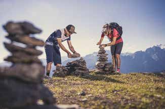
14 - 15

                                                                                                                                                                                            Durlassboden trails
                                                                                                                                                                                         DURLASSBODEN
                                                                          IDEALE URLAUBSHÖHE Ideal vacation altitude
           Trails Stausee Durlassboden Reservoir trails                   Die durchschnittliche Höhenlage der Strecken von 1.200 bis 1.400 m
                                                                          stellt einen leichten Höhenreiz für den Körper dar, der vor allem die
          Route 6   STAUSEERUNDE run around the reservoir                 Sauerstoff-Transportfunktion verbessert, was einen sehr wesentlichen
                    Ausgangspunkt: Seestüberl an der Dammkrone            Trainingseffekt bedeutet.

                                                                                                                                                                                · Reservoir
                    Starting point: Seestüberl at the reservoir           The average altitude of the routes from 1,200 to 1,400 m represents

                                                                                                                                                                     TRAILS STAUSEE
                    Länge Length: 10,2 km                                 a slight height stimulus for the body, improves especially the oxygen
                                                                          transport function which represents a very significant training effect.
          Route 7   2-SEEN-RUNDE run around the 2 reservoirs

                                                                                                                                                    TRAILS STAUSEE DURLASSBODEN
                    Ausgangspunkt: Seestüberl an der Dammkrone
                    Starting point: Seestüberl at the reservoir        6 STAUSEERUNDE 10,2 km
                    Länge Length: 13,2 km                                 Run around the reservoir
                                                                               106 hm                12%          0,5%       1.459 m
                    Ausgangspunkt starting point                               10 hm/km              29 hm                   1.407 m

                                                                              Kurzcharakter           leichte verlaufende Strecke
                                                                              General information     easy running route
                                                                              Weg                     Schotterwege, Asphalt, Wald- und Wiesenwege
                                                                              Way                     gravel, asphalt, forest and meadow paths
                          7                                                   Ausgangspunkt           Seestüberl an der Dammkrone
                                                                              Starting point          Seestüberl at the reservoir
                                                                              Höhenprofil
                                         6
                                                                              elevation profile

          INFORMATION
             Summe der zurückgelegten Höhenmeter
             total meters of altitude                                     Vom Startpunkt entlang der Nordseite des Stausees über Wald- und
             durchschnittlich zurückgelegte Höhenmeter pro Kilometer      Wiesenwege bis zur Brücke bei der Schütthofalm. Zurück Richtung
             average distance in meters of altitude per kilometres        Start am See entlang, vorbei an den Almen und am Ende noch über die
             maximale Steigung in Prozent                                 Dammkrone.
             maximum acclivity in percent                                 From the starting point along the north side of the reservoir through
             längste durchgehende Steigung in Höhenmeter                  forest and meadow paths to the bridge at the „Schütthofalm“. Back
             longest continuous acclivity in meters of altitude           along the reservoir towards the starting point, passing the alpine
             durchschnittliche Steigung in Prozent                        pastures and at the end across the dam crest.
             average acclivity in percent
             Höchster Punkt
             highest point                                             7 2-SEEN-RUNDE 13,2 km
             Niedrigster Punkt                                            Run around the 2 reservoirs
             lowest point                                                      107 hm                12%          0,4%       1.459 m
                                                                               8 hm/km               29 hm                   1.407 m

                                                                              Kurzcharakter           anspruchsvolle Strecke
                                                                              General information     demanding route
                                                                              Weg                     Schotterwege, Asphalt, Wald- und Wiesenwege
                                                                              Way                     gravel, asphalt, forest and meadow paths
                                                                              Ausgangspunkt           Seestüberl an der Dammkrone
                                                                              Starting point          Seestüberl at the reservoir
                                                                              Höhenprofil
                                                                              elevation profile

                                                                          Die Runde verläuft gleich wie die Stauseerunde, jedoch umrundet
                                                                          man den zweiten See bis zum Alpengasthof Finkau. Tipp: sehr schöne
                                                                          Wanderung, empfehlenswert!
                                                                          This run is the same as the run around the reservoir, however, you go
                                                                          around the second lake to the Alpengasthof Finkau. Tip: very nice hike,
                                                                          recommended!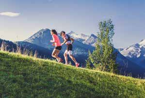
Aktiv WELLNESS           PHILOSOPHIE · Philosophy

» Aktive Erholung und natürliches                                           » Is active recreation and natural
  Wohlbefinden am Berg                                                        wellbeing in the mountains
» Fördert mit sanften Wanderungen und                                       » Stimulates health with gentle hikes
  unkomplizierten Wellnessübungen die                                         and easy wellness exercises
  Gesundheit
» Mobilisiert durch Ruhe und Besinnung                                      » Awakens through peace and
  Ihre innere Kraft und Harmonie                                              reflection your inner strength and
                                                                              harmony
» Bietet wertvolle Gesundheits- und
  Wellnesstipps für zu Hause an                                             » Offers valuable health and
                                                                              wellness tips for home

                                                                    München
                                                                                                        Wien

                                           D
                                                                                               Salzburg
                                        Achenpass                            Kufstein
     Arlbergpass

                        Innsbruck    A12                           St.Johann                 Lofer
CH
                                                      Wiesing                 Kitzbühel
                                                                                                  Saalfelden
                                       Zillertal

                                                                                          Pass
                        A13

                                               B169

                                                                                          Thurn
                                                      Gerlos- Königsleiten Wald                                Bischofshofen
                                                      stein
                      Brennerpass      Zell
                                                        Gerlos    Gerlos-    Krimml     Mittersill Zell/See
                              I                                    pass
                                                      Mayrhofen

                                    Hintertux

     appy &                         www.zillertalarena.com/sicherheit
h

       safe

                                                          Zell-Gerlos
                                                          600m      1.300m

                          Tourismusverband Zell-Gerlos
                                     TVB Zell-Gerlos Büro Gerlos
                              A-6281 Gerlos 141 · Tel. +43/(0)5284/5244-0
                               gerlos@zell-gerlos.at · www.zell-gerlos.at

                                   TVB Zell-Gerlos Büro Zell
                   A-6280 Zell am Ziller · Dorfplatz 3a · Tel. +43/(0)5282/2281-0
                             zell@zell-gerlos.at · www.zell-gerlos.at
Sie können auch lesen