HYDROGRAPHISCHE NACHRICHTEN
←
→
Transkription von Seiteninhalten
Wenn Ihr Browser die Seite nicht korrekt rendert, bitte, lesen Sie den Inhalt der Seite unten
tation. These will be used to extract the reference
age rays in the water. The scanner is designed for
HYDROGRAPHISCHE
laser with wavelength 532 nm is used, because of
g the ground of a waterbody and available high ener
NACHRICHTEN
ean point density of the obtained point cloud is abo
model.
Journal of Applied Hydrography 06/2020 HN 116
Fokusthe
ma:
Fernerku
ndung
und Lase
r
bathyme
trie
AR-derived Digital Terrain Model Autobahnsee.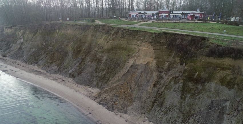
Ocean engineering
Consulting

                                               from space into depth
                                        Realise your projects in cooperation with our hydrographic services

                                                                Our hydrography engineers are happy to develop
                                                                systems tailored exactly to your needs and to
                                                                provide professional advice and support for
                                                                setting up your systems and training your staff.

                                                                MacArtney Germany benefits from being part of
                                                                the MacArtney Group and enjoys unlimited access
                                                                to cutting-edge engineering competences and
               CTDs & SVPs                                      advanced facilities.

                                                Acoustic
                                                sensors

                                                                   Software

                         Position and
                       motion sensors

                                                                   Integration

             Denmark Norway Sweden    United Kingdom France        Italy   Netherlands         Germany
                      USA   Canada   South America    Australia   Singapore        China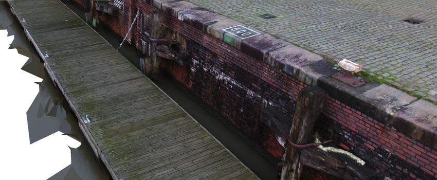
Vorwort
Liebe Leserinnen und Leser,
als wir im Kreis der Redaktion das Fokusthema für Bei den Beiträgen, die sich damit beschäftigen,
diese Ausgabe festgelegt haben – nämlich »Fern- die Gewässer aus der Luft zu erfassen, fällt auf, dass
erkundung und Laserbathymetrie« –, da dachten sie Lösungen aufzeigen, wie die bisherige Daten-
wir (die sieben Redakteure), was den Terminus lücke im Übergangsbereich zwischen Wasser und
Fernerkundung anbelangt, an unterschiedlichste Land geschlossen werden kann. Damit hört die
Dinge. Das sollte sich aber erst im Nachhinein he- Hydrographie nicht mehr auf, wo das Vermes-
rausstellen. sungsboot nicht mehr weiterkommt, sondern die
Für mich war Fernerkundung mehr oder we- Gewässergrenzen werden nun auch mit erfasst.
niger alles, was von oben aus der Luft aus statt- Außerdem im Heft: Die Fortsetzung eines Bei-
findet. Ich dachte an Satelliten, an Flugzeuge, an trags aus der letzten Ausgabe zur Meeresspiegel-
Drohnen. Daher fand ich es nur folgerichtig, die forschung (S. 60), ein Beitrag über das Wanderver-
Laserbathymetrie explizit zu nennen, um eine be- halten von Munition im Meer (S. 72) sowie eine Lars Schiller
sondere Fernerkundungsmethode hervorzuheben. Vorstellung eines kostengünstigen Multi-Sensor-
Kollegen dachten beim Stichwort Fernerkun- Systems (S. 68).
dung zusätzlich – wenn nicht sogar zuvorderst – Mit letztgenanntem Artikel wurde übrigens
auch an Schiffe und an ROVs, sie dachten an Echo- Louis Makiello zum DHyG Student Excellence
lotung und an Unter-Wasser-Photogrammetrie. Award nominiert. Der Beitrag eines weiteren Kan-
Und in der Tat, die Vermessung mit einem Fä- didaten für den Preis, mit dem die DHyG heraus-
cherecholot findet natürlich auch aus der Ferne ragende Studienleistungen auszeichnet, erschien
statt; weder wird der Untersuchungsgegenstand bereits in Ausgabe HN 114 (S. 18), darin vergleicht
betreten noch wird er berührt. Christian John Vietheer verschiedene Inertialmess-
Das vorliegende Heft gibt Einblick in die Band- systeme. Mit dem Preis ausgezeichnet wird in die-
breite der in der Hydrographie verwendeten Fern- sem Jahr Hannes Nübel, der sich damit beschäftigt
erkundungsmethoden. Drei Beiträge beschäftigen hat, wie sich Gewässertiefen aus multispektralen
sich mit Laserbathymetrie (S. 6, S. 32, S. 78), und Luftbildern ableiten lassen (S. 32) – ein Thema, das
auch im Wissenschaftsgespräch dreht sich al- allzu gut in dieses Heft passt.
les um grüne Laser und um den Übergang vom Insgesamt finden Sie in dieser Ausgabe 14 Bei-
Wasser zum Land (S. 52). In drei Beiträgen geht träge, davon acht in englischer Sprache. Die bei-
es um Photogrammetrie, im ersten um die Erfas- den ersten Fachbeiträge haben sogar Peer-Re-
sung des Uferstreifens (S. 16), im zweiten um die view-Verfahren durchlaufen, die Patrick Westfeld
Untersuchung von Wracks (S. 23), im dritten um als verantwortlicher Redakteur begleitet hat.
die Beurteilung von Hafeninfrastrukturen (S. 36). »Die Communitys zueinander bringen«, dies ist
Zwei weitere Beiträge thematisieren, wie man aus der Titel des Wissenschaftsgesprächs mit Gottfried
Satellitendaten die Gewässertiefen ableitet (S. 40, Mandlburger. Und es ist auch das Bestreben der
S. 48). Und ein Kurzbeitrag zeigt die Möglichkeiten Redaktion mit diesem Heft. Dass das in der Praxis
der Satellitenaltimetrie auf (S. 77). schon oft geschieht, zeigen manche Beiträge.
Hydrographische Nachrichten Chefredakteur:
HN 116 – Juni 2020 Lars Schiller
E-Mail: lars.schiller@dhyg.de
Journal of Applied Hydrography
Redaktion:
Offizielles Organ der Deutschen Hydrographischen Peter Dugge, Dipl.-Ing.
Gesellschaft – DHyG Horst Hecht, Dipl.-Met.
Holger Klindt, Dipl.-Phys.
Herausgeber: Dr. Jens Schneider von Deimling
Deutsche Hydrographische Gesellschaft e. V. Stefan Steinmetz, Dipl.-Ing.
c/o Innomar Technologie GmbH Dr. Patrick Westfeld
Schutower Ringstraße 4
18069 Rostock Hinweise für Autoren und Inserenten:
www.dhyg.de > Hydrographische Nachrichten >
ISSN: 1866-9204 © 2020 Mediadaten und Hinweise
HN 116 — 06/2020 3
Sonic 2020                         Sonic 2022

       Sonic 2024                         Sonic 2026

     Beispiellose Leistungsfähigkeit mit 256 Beams und 1024
     Soundings bei 160° Öffnungswinkel (einstellbar) und einer Pingrate
     von 60 Hz
     Breitbandtechnologie mit Frequenzwahl in Echtzeit zwischen 200
     bis 400 kHz sowie 700 kHz optional
     Dynamisch fokussierende Beams mit einem max. Öffnungswinkel
     von 0,5° x 1° bei 400 kHz bzw. 0,3° x 0,6° bei 700 kHz
     Höchste Auflösung bei einer Bandbreite von 60 kHz, bzw. 1,25 cm
     Entfernungsauflösung
     Kombinierbar mit externen Sensoren aller gängigen Hersteller
     Flexibler Einsatz als vorausschauendes Sonar und der Fächer ist
     vertikal um bis zu 30° schwenkbar
     Zusätzliche Funktionen wie True Backscatter und Daten der
     Wassersäule
     MultiSpectral Modus™, der es den R2Sonic-Systemen ermöglicht,
     Backscatter Daten mehrerer Frequenzen in einem einzigen Durch-
     lauf zu sammeln

     Nautilus Marine Service GmbH ist der kompetente Partner in
     Deutschland für den Vertrieb von R2Sonic Fächerecholotsystemen.
     Darüber hinaus werden alle relevanten Dienstleistungen wie Instal-
     lation und Wartung kompletter hydrographischer Vermessungssys-
     teme sowie Schulung und Support für R2Sonic Kunden angeboten.
     R2Sonic ist ein amerikanischer Hersteller von modernen Fächerecho-
     loten in Breitbandtechnologie. Seit Gründung des Unternehmens
     im Jahr 2009 wurden weltweit bereits mehr als 1.500 Fächerlote
     ausgeliefert und demonstrieren so eindrucksvoll die
     außergewöhnliche Qualität und enorme Zuverlässigkeit dieser
     Vermessungssysteme.

Nautilus Marine Service GmbH · Alter Postweg 30 · D-21614 Buxtehude · Phone: +49 4161-559 03-0 · info@nautilus-gmbh.com
R2Sonic, LLC · 5307 Industrial Oaks Blvd. · Suite 120 · Austin, Texas 78735 · U.S.A. · Phone: +1-512-891-0000 · r2sales@r2sonic.com
Inhaltsverzeichnis
Fernerkundung und Laserbathymetrie
Laser bathymetry
6 A review of airborne laser bathymetry for mapping of inland and coastal waters
A peer-reviewed paper by GOTTFRIED MANDLBURGER
UAS photogrammetry I
16 Coastal cliff monitoring using UAS photogrammetry and TLS
A peer-reviewed paper by THOMAS P. KERSTEN, MAREN LINDSTAEDT and KLAUS MECHELKE
Underwater photogrammetry
23 Fusing ROV-based photogrammetric underwater imagery with multibeam soundings
for reconstructing wrecks in turbid waters
An article by ROBIN ROFALLSKI, PATRICK WESTFELD, JEAN-GUY NISTAD, ANNETT BÜTTNER and THOMAS LUHMANN
DHyG Student Excellence Award I
32 Bathymetry from multispectral aerial images via convolutional neural networks
An article by HANNES NÜBEL
UAV-Photogrammetrie II
36 Drohnengestützte Erfassung von maritimen Infrastrukturen
Ein Beitrag von DAVID HEUSKIN und FRANK LEHMANN
Satellite-derived bathymetry
40 Satellite-derived bathymetry in practice
An article by MARINA NIEDERJASPER
Remote sensing
48 Hydrographic remote sensing made in Germany
An article by KNUT HARTMANN and THOMAS HEEGE
Wissenschaftsgespräch
52 »Die Communitys zueinander bringen«
GOTTFRIED MANDLBURGER im Interview
Wasserstandsmessungen
60 Retrospektive der Meeresspiegelforschung in Deutschland
Teil 2: Deutsche Ostseeküste
Ein Beitrag von JESSICA KELLN und JÜRGEN JENSEN
DHyG Student Excellence Award II
68 Using a ROS-based low-cost system for bathymetric surveys
An article by LOUIS MAKIELLO
UXO movements
72 Potential UXO seabed migration in the German Bight
An article by CHRIS JENKINS and SONIA PAPILI
Satellitenaltimetrie
77 Lokal optimierte Nutzung der Satellitenaltimetrie zur Erfassung des Meeresspiegels
Ein Beitrag von THOMAS ARTZ, ROBERT WEISS, SASKIA ESSELBORN, JULIA ILLIGNER und TILO SCHÖNE
Produkttests
78 Erprobung des neuartigen Single-Photon-LiDAR-Messsystems Leica SPL100
Ein Beitrag von ROBERT WEISS, GOTTFRIED MANDLBURGER und THOMAS ARTZ
Produktvorstellung
80 Objekterkennung im Untergrund
Ein Beitrag von GUILLAUME JOUVE und LIONEL FAURE
HN 116 — 06/2020 5
Laser bathymetry DOI: 10.23784/HN116-01
A review of airborne laser bathymetry
for mapping of inland and coastal waters
A peer-reviewed paper by GOTTFRIED MANDLBURGER
Airborne laser bathymetry (ALB), an active remote sensing technique for capturing
the depth and topography of shallow inland and coastal waters, is continuously evolv-
ing due to technological progress concerning sensors, platforms and data processing
methods. So-called deep bathy systems with low spatial resolution but high depth
penetration of up to 60 m coexist with topo-bathymetric sensors featuring small laser
footprints of around 50 cm, high measurement point density of more than 20 points/m2
but limited depth penetration of about 1.5 Secchi depths. While conventional ALB sen-
sors are typically mounted on manned aircraft and operated from flying altitudes of
around 500 m, sensor miniaturisation enabled the integration of compact bathymetric
laser scanners on agile unmanned aerial vehicles (UAV) operated from 50 to 150 m
altitude for flexible acquisition of smaller water bodies like clear gravel-bed rivers.
This in turn, initiated new applications like roughness estimation, mapping of ben-
thic habitats, and monitoring of coastal and fluvial morpho-dynamics in high spatial
and temporal resolution. Furthermore, new data processing approaches proved to
enhance both accuracy and depth penetration via strict geometric modelling and so-
phisticated waveform processing. The paper reviews the current trends in airborne
laser bathymetry and highlights the potential and restriction of this optical technique.
bathymetric LiDAR | green laser | laser scanning | ALB sensors | ALB platforms
bathymtrisches LiDAR | grüner Laser | Laserscanning | ALB-Sensoren | ALB-Plattformen
Die luftgestützte Laserbathymetrie (ALB) ist eine aktive Fernerkundungstechnik, mit der sich die Tiefe und
Topographie von flachen Binnen- und Küstengewässern erfassen lässt und die sich aufgrund des technolo-
gischen Fortschritts bei Sensoren, Plattformen und Datenverarbeitungsmethoden ständig weiterentwickelt.
Neben sogenannten Tiefwassersystemen mit geringer räumlicher Auflösung, aber hoher Eindringtiefe von
bis zu 60 m gibt es topo-bathymetrische Sensoren, die kleine Footprints von etwa 50 cm und eine hohe
Messpunktdichte von mehr als 20 Punkten/m² aufweisen, aber nur eine begrenzte Eindringtiefe von etwa 1,5
Secchi-Tiefen. Während herkömmliche ALB-Sensoren typischerweise auf bemannten Flugzeugen montiert
sind und aus Flughöhen von etwa 500 m betrieben werden, ermöglichte Sensorminiaturisierung die Integra-
tion kompakter bathymetrischer Laserscanner auf agilen unbemannten Luftfahrzeugen (UAV), wodurch klei-
nere Wasserkörper wie klare Flüsse mit Kieselbett aus einer Flughöhe von 50 bis 150 m flexibel erfasst werden
können. Dies wiederum ermöglichte neue Anwendungen wie die Schätzung der Rauigkeit, die Kartierung
benthischer Lebensräume und die Überwachung der Morphodynamik von Küstengewässern und Flusssys-
temen in hoher räumlicher und zeitlicher Auflösung. Darüber hinaus verbesserten neue Datenverarbeitungs-
ansätze durch strenge geometrische Modellierung und hochentwickelte Wellenformverarbeitung sowohl die
Genauigkeit als auch die Eindringtiefe. Der Beitrag gibt einen Überblick über die aktuellen Trends in der luft-
gestützten Laserbathymetrie und zeigt das Potenzial und die Einschränkungen dieser optischen Technik auf.
Author 1 Introduction column. Additional reflections from the air-water-
Dr. Gottfried Mandlburger is a Airborne laser bathymetry (ALB), also referred interface are used to reconstruct the 3D-shape of
Senior Researcher at TU Wien, to as airborne laser hydrography (ALH), is a tech- the water surface. Exact knowledge of the height
Department of Geodesy and nique for measuring the depths of relatively shal- and tilt of the water surface is a precondition to
Geoinformation. low coastal and inland water bodies with a pulsed correct the raw measurement due to refraction ef-
scanning laser from the air (Guenther et al. 2000). fects at the air-water-interface (Westfeld et al. 2017;
gottfried.mandlburger@ The employed lasers are operating in the visible Birkebak et al. 2018; Richter et al., 2018).
geo.tuwien.ac.at green domain of the electromagnetic spectrum The measurable depth of this active remote
(λ = 532 nm) and the depths are determined by sensing technique mainly depends on the opti-
measuring the round trip time of short laser pulses cal properties of the water body (i.e. turbidity).
reflected from the bottom of the water body after State-of-the-art bathymetric sensors can meas-
traveling through the atmosphere and the water ure depths in the range of 1 to 3 times the Secchi
6 Hydrographische Nachrichten
Peer-reviewed paper                                                                                                Laser bathymetry

depth (SD), corresponding to 20 to 60 m for clear         propagation speed reduces. Both beam deflec-
coastal waters with a diffuse attenuation coef-           tion and change of signal propagation velocity are
ficient of k < 0.1 (Guenther 1985; Mobley 1994). In       described by Snell’s law:
addition to depth and bottom topography, ALB
allows the estimation of turbidity by analysing             			      sin αair   c     n
                                                                              = air = water
the full waveform (FWF) of the backscattered la-            			    sin αwater  cwater  nair
ser pulses (Abdallah et al. 2012; Richter et al. 2017;
Zhao et al. 2018). It is noted that in this context the   With:    nair = c0/cair ≈ 1.0
term full waveform denotes the temporal record             			     nwater = c0/cwater ≈ 1.33
of the received laser signal amplitude (Wagner
2010) rather than the shape of water waves.               To ensure eye safe operation, green laser beams
   Whereas traditional hydrographic mapping               are generally broader compared to infrared (IR) la-
via sonar (sound navigation and ranging) yields           sers used for topographic application. Typical laser
a higher penetration depth (>100 m), ALB is well          beam divergences range from 1 to 7 mrad result-
suited for capturing the shallow near shore area          ing in a diameter of the illuminated footprint area
(Guenther et al. 2000) as well as unnavigable and         at the water surface of 50 to 350 cm for a nominal
ecologically sensitive areas with restricted access       flying altitude of 500 m. Further non-linear beam
(Pfennigbauer et al. 2011). This article provides a       spreading takes place in the water column caused
compact airborne laser bathymetry review and is           by volume scattering at floating and suspended
structured as follows: Section 2 introduces the ba-       particles (cf. hyperbolic underwater light cone,
sic principles of ALB. Section 3 discusses available      Fig. 1). Signal attenuation in water is exponential
sensor and platform concepts and section 4 lists          as a result of scattering and absorption and leads
potential applications. The article concludes with        to asymmetric shapes of the received echo wave-
a summary and remarks on current trends in sec-           form (Tulldahl and Steinvall 2004; Abdallah et al.
tion 5.                                                   2012). Typical water waveforms show a first peak
                                                          from the water surface, followed by an asymmetric
2 Basics of airborne laser bathymetry                     descent in the water column and a weak response
The principles of ALB are summarised in Pfeifer,          from the water bottom. Next to the receiver sensi-
Mandlburger and Glira (2015) and in Philpot (2019).       tivity, the maximum penetration capability of any
Fig. 1 shows a conceptual drawing of the meas-            ALB system is limited by the water optical prop-
urement process. A short laser pulse in the green         erties, i.e., turbidity, which is described either by
domain of the spectrum (λ = 532 nm) is emitted            the diffuse attenuation coefficient k or the Secchi
from the scanner mounted on an aerial platform            depth SD (Guenther 1985; Guenther et al. 2000).
(aircraft, helicopter, UAV, etc.), travels through the       The attenuation coefficient k appears as the ex-
atmosphere and hits the water surface, where a            ponent in the water column term of the laser-radar-
part of the signal is scattered back. The remaining       equation (Tulldahl and Steinvall 1999; Abdallah et
part propagates through the water column with             al. 2012; Pfeifer, Mandlburger and Glira 2015) and,
reduced propagation speed, is reflected from the          thus, influences the asymmetric signal decay in the
water bottom, and a small portion of the emitted          received echo waveform. Turbid water conditions
laser power reaches the sensor’s receiver after the       (k = 1) lead to a steeper signal decay compared
return trip. Based on the time-of-flight principle        to clear water (k = 0.1). SD is an empirical turbidity
ranges are derived from the round trip time, i.e.,        measure. It denotes the distance, where the black
the time span between pulse emission and ar-              and white quadrants of a 20 cm or 30 cm check-
rival of the backscattered echo pulse. In ALB, the        erboard disk lowered into the water can no longer
complete waveform of the backscattered signal is          be distinguished. k and SD are approximately re-
digitised with high temporal resolution (typically        lated by SD ≈ 1.6/k (ISO 2019). The most powerful
0.5 ns). Pulse detection is achieved by analysing         bathymetric laser scanners feature a depth perfor-
the full echo waveform either online in the instru-       mance of approximately 3 SD. Thus, ALB is restricted
ment (Pfennigbauer et al. 2014) or in post process-       to depths less than 60 m in very clear water condi-
ing (Allouis et al. 2010; Abady et al. 2014; Schwarz et   tions with SD = 20 m (k = 0.08). Such ideal condi-
al. 2019). Surface and bottom detection is exempli-       tions apply to certain coastal waters (e.g., Caribbean
fied in the sketch of the received echo waveform          Sea) and calm sea state. In contrast, unfavourable
in Fig. 1 as two gray Gaussian curves.                    environmental conditions (wind, thunderstorms,
   ALB is a multimedia measurement technique              snow melt, etc.) entail higher suspended sediment
with the laser pulses travelling in air and water.        concentration (SSC), which reduces the measurable
The two media are characterised by their refrac-          depth to less than 10 m.
tive indices nair and nwater describing the relative         Precise knowledge of the 3D shape of the wa-
signal propagation speed in vacuum (c0) and the           ter surface is a prerequisite for applying refraction
respective media (cair, cwater). At the air-water-        and run-time correction of the raw laser measure-
interface the laser beam gets deflected and the           ments which, in turn, is a precondition for obtain-

HN 116 — 06/2020                                                                                                                 7
Laser bathymetry

                   ing precise water depths and underwater topog-                      green laser returns only. In the latter case, sophis-
                   raphy (Thomas and Guenther 1990; Guenther et al.                    ticated waveform modelling (Schwarz et al. 2019)
                   2000). When using green laser radiation only, water                 or spatial aggregation (Mandlburger, Pfennig-
                   surface returns always constitute a mixture of re-                  bauer and Pfeifer 2013) are necessary to minimise
                   flections from the surface and sub-surface volume                   systematic water surface underestimation. Surface
                   backscattering (Guenther 1986; Guenther et al.                      model simplification, however, limits the achiev-
                   2000). This typically leads to water level underes-                 able depth accuracy and leads to systematic errors
                   timation (Mandlburger 2017). Thus, traditional ALB                  (Westfeld et al. 2017; Richter et al. 2018).
                   systems use an additional non-water penetrating                        Apart from these bathymetry specific and pulse
                   IR laser, synchronously and collinearly emitted with                related tasks (surface and bottom echo detection,
                   the green laser to capture the shape of the water                   refraction and run time correction, etc.), 3D point
                   surface. Today, most instruments abdicate the use                   cloud generation is identical to the topographic
                   of a co-aligned IR laser and either use a separate IR               case. In a process referred to as direct georeferenc-
                   scanner as depicted in Fig. 1 or entirely drop the IR               ing, scanner measurements (range, scan angle) are
                   channel and estimate the water surface from the                     combined with position and attitude information

                                                       Transmitted                                              Transmitted
                                                                                                                Laser Signal                                     Refraction index
                                                       Laser Signal
                                                                                    waveform PT(t) [DN]
                    waveform PT(t) [DN]

                                                                                                                                                                 nair ... Air
                                                                                                                                                                 nwater ... Water
                                                                                    Transmitted
                    Transmitted

                                                                                                                                                                 Speed of light
                                                                              20°                                                                                c0 ... Vacuum
                                                                                                                                                                 cair ... Air
                                                                                                                                                                 cwater ... Water
                                                   0      3     time [ns]                            0                                 1    time [ns]

                                                       Received                                                                            Received Echo Signal
                                                       Echo Signal
                                                                                                            Echo waveform PR(t) [DN]
                        Echo waveform PR(t) [DN]

                                                                   water                                                                                        water surface
                                                                   surface                                                                                        water body
                                                                                                                                                                       bottom

                                                         4260     time [ns]                                                                      4260           4270 time [ns]
                                                                                                                                           air          water
                                                                                                          nair = c0 / cair
                                      FAC E
                        WAT E R S U R

                                                                                                          nwater = c0 / cwater
                                                                                                                                                                                           Figure adapted from Pfeifer, Mandlburger and Glira (2015)

                                                                                                                                                                                      na
                                                                                                                                                                   © GEO :: TU Vien
                      B OT TO M O F WAT E R B O DY

                   Fig. 1: Conceptual drawing of the principle of airborne laser bathymetry

8                                                                                                                                                 Hydrographische Nachrichten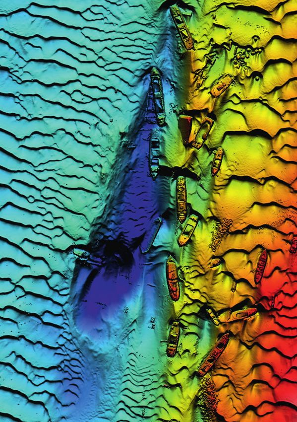
Laser bathymetry

from a navigation device consisting of a global                     per pulse basis (Wozencraft and Lillycrop 2003;
navigation satellite system (GNSS) receiver and an                  Fuchs and Tuell 2010). Other sensors use disjoint
inertial measurement unit (Vosselman and Maas                       infrared and green lasers (cf. Fig. 1), resulting in
2010; Shan and Toth 2018).                                          precise reconstructions of static water surfaces
                                                                    from the non-water penetrating infrared channel.
3 Sensors and platforms                                             Many of today’s instruments, however, use green
ALB systems can be categorised into deep                            lasers only to detect both water surface and bot-
bathymetric, topo-bathymetric, and multi-purpose                    tom (Pfennigbauer et al. 2011; Wright et al. 2016).
sensors. The aim of deep bathymetric scanners is                    This poses challenges for water surface modelling,
maximising depth penetration for mapping coastal                    as laser echoes from the water surface constitute a
waters. These systems utilise relatively long and                   mixture of specular reflections from the air-water
broad laser pulses (pulse duration: 7 ns, beam di-                  interface and sub-surface volume backscattering,
vergence: 7 mrad), high pulse energy (7 mJ), and a                  which demands sophisticated data processing for
low measurement rate (3 to 10 kHz) entailing large                  obtaining precise water surface models (Thomas
laser footprints and low point density. Capturing                   and Guenther 1990; Birkebak et al. 2018; Mandl-
smaller inland waters, in turn, requires higher spatial             burger et al. 2013; Schwarz et al. 2019).
resolution. Therefore, state-of-the-art topo-bathy-                    Another possibility for categorising ALB sensors
metric sensors use short and narrow laser beams                     is the carrier platform. While deep bathymetric
(pulse duration: 1 to 2 ns, beam divergence: 0.7 to                 systems are typically bulky with a weight of 50 to
2 mrad) and higher pulse repetition rates of up to                  100 kg and require larger aircraft, topo-bathymetric
500 kHz resulting in laser footprint diameters of 0.5               systems are more compact in size and weight and
to 1 m and a point density of around 20 points/m².                  can be integrated in light aircraft and helicopters.
Topo-bathymetric scanners, however, only feature                    Ongoing sensor miniaturisation currently leads to
a maximum penetration of around 1.5 SD. In the re-                  the development of lightweight bathymetric laser
cent years, multi-spectral and single photon LiDAR                  scanners (5 to 15 kg) suitable for integration in gy-
scanners were introduced in the market. The prior                   rocopters, helicopters and even unmanned aerial
enable the derivation of vegetation indices featur-                 vehicles (UAV).
ing both infrared and green laser wavelengths (Fer-                    Table 1 summarises the key parameters of differ-
nandez-Diaz et al. 2016) and the latter is primarily                ent deep bathymetric and topo-bathymetric sen-
used for large scale topographic mapping (Degnan                    sors. The reported pulse energy, pulse duration,
2016), but both also feature bathymetric capabili-                  beam divergence and depth penetration values
ties. Single photon technology is also used by the                  always refer to the bathymetric channels. If more
LiDAR instrument aboard the ICESat-2 satellite (Par-                than one green laser channel is available (Hawk-
rish et al. 2019).                                                  Eye 4X, CZMIL Nova, EAARL-B), the values refer to
   Apart from depth penetration, ALB systems                        the deep water channel. Although deep and shal-
differ with reference to the utilised laser wave-                   low water channels both use the same laser wave-
lengths. As stated before, traditional ALB systems                  length (λ = 532 nm), the higher penetration depth
utilise coaxial infrared and green laser beams for                  of the deep water channels is generally achieved
water surface and water bottom detection on a                       by using higher pulse energy, longer pulse dura-

                                LADS HD         HawkEye 4X       CZMIL Nova     VQ-880-GII      Chiroptera 4X      EAARL-B
                                              deep bathymetric                                 topo-bathymetric
Weight [kg]                        n/s              ~170             290            65                n/s              n/s
Dimensions [cm]                    n/s               n/s         89 × 60 × 90   52 × 52 × 69     ~67 × 53 × 75         n/s
Laser channels [nm]                532          532/532/1064     532/532/1064    532/1064          532/1064         532/532
Camera                        RGB + hypersp         RGBI       RGB + hypersp       RGB               RGBI             –––
Measurement rate [kHz]             3.0           40/140/500        10/70/80       700/279          140/500           15–30
Pulse energy [mJ]                   7                 3               4             n/s               0.1           0.4/0.13
Pulse duration [ns]                 ~7                2               3             1.5                4               1.3
Field of view [°]                  n/s               40              40             40                40               44
Beam divergence [mrad]              7                 7               7            0.7–2              ~3                1
Nominal flying altitude [m]     365–900           400–600         400–1000       600–700           400–600            300
Laser footprint [cm]            270–630           280–420          280–700        40–280           120–180             30
Scan pattern                    rectilinear       elliptical       circular       circular         elliptical     elliptical arc
Depth performance [SD]             3.0               3.0             3.0            1.5               1.7              2.5

Table 1: Key parameters of deep bathymetric and topo-bathymtric laser scanners

HN 116 — 06/2020                                                                                                                                 9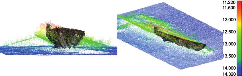
Laser bathymetry
BDF-1 ASTRALite RAMSS VQ-840-G includes all possible error factors like positioning,
orientation, boresight alignment, ranging, as well
Weight [kg] 5.3 5.0 14 12
as uncertainties related to water surface and water
Dimensions [cm] 45 × 18 × 14 27 × 23 × 19 ~42 × 37 × 760 36 × 29 × 20 column (Eren et al. 2019).
Camera RGB ––– RGB RGB Table 2 summarises the key parameters of the
Measurement rate [kHz] 4 20 25 50–200 latest generation of compact bathymetric laser
Pulse duration [ns] 1.2 n/s 5.1 1.5 scanners which also allow integration on UAVs.
Field of view [°] n/s 30 45 40
These small and lightweight sensors are oper-
ated from 20 to 150 m resulting in smaller laser
Beam divergence [mrad] n/s 12 n/s 1–6
footprints in the dm-range. The generally high
Flying altitude [m] 20 20 325 50–150 measurement rate of 20 to 200 kHz entails a point
Laser footprint [cm] 3.5 24 n/s 5–90 density of more than 50 points/m² which opens
Scan mechanism no scanning rectilinear pushbroom elliptical new possibilities for small object detection and
Depth performance [SD] 1.5 1.5 3.0 2.0 roughness estimation (Mandlburger et al. 2020).
The depth measurement performance is on par or
Table 2: Key parameters of bathymetric UAV-laser sensors even better compared to topo-bathymetric sen-
sors operated from manned platforms. In addition,
the mobilisation costs are lower and the use of
tion and a larger beam divergence. Table 1 clear- agile airborne platforms make these instruments
ly shows that the deep water systems provide a especially well-suited for capturing medium sized
maximum penetration depth of around 3 SD rivers when integrated on UAV platforms but also
but feature a large laser footprint diameter in the for capturing coastal areas when integrated on
range of 3 to 7 m and a moderate measurement light aircraft.
rate of 3 to 40 kHz resulting in point densities of Fig. 2 shows selected ALB scanners featuring in-
≤2 points/m². The topo-bathymetric scanners and struments with deep water channels (a, b), topo-
the shallow water channels of deep bathymetric bathymetric sensors designed for manned aircraft
scanners, in turn, are optimised for high resolution (a, b, c, d) and compact topo-bathymetric sensors
mapping. They feature smaller footprint diameters designed for UAV-integration (e, f). Except f, all in-
in the m-range, higher measurement rates of up struments feature digital cameras in addition to
to 700 kHz resulting in a water bottom point den- the LiDAR sensors and therefore fall into the cat-
sity of around 20 points/m² at the price of limited egory of hybrid mapping sensors.
depth penetration capability (1.5 SD). Most of the
sensors are equipped with RGB cameras for the 4 Applications
prime purpose of photo documentation. Some The applications of ALB are manifold and constant-
instruments, however, also integrate high-resolu- ly increasing as the available sensors are getting
tion metric cameras (e.g. PhaseOne IXU, RDC30) more versatile on the one side and more compact
allowing bathymetric mapping also from con- on the other side. In the following, some exemplary
currently captured images via multimedia stereo applications and related publications are listed.
photogrammetry (Westaway, Lane and Hicks 2001; • Underwater object detection: The first applica-
Maas 2015; Mandlburger 2019) or spectrally based tion of bathymetric LiDAR was underwater ob-
depth estimation (Lyzenga, Malinas and Tanis ject detection for military purposes (Sorenson,
2006; Legleiter, Dar and Rick 2009). Honey and Payne 1966). More recent civil ap-
Deep water channels generally use high energy plication in the maritime domain include object
laser pulses which require powerful laser sources detection for maintaining harbour security, safe
on the one hand and longer pulse durations on navigation of autonomous underwater vehicles,
the other hand. The latter has an implication con- and safety of the littoral zone (Matteoli et al.
cerning the minimum detectable depth, as sur- 2015). In any case, the detection of small objects
face and bottom echoes conflate to a single peak requires sophisticated full waveform analysis
in the received waveform. For this reason, topo- (Tulldahl and Steinvall 1999). While ALB sensors
bathymetric scanners dedicated to shallow water operated from manned platforms feature foot-
mapping generally use very short laser pulses of print diameters in the m-range, detection and
around 1 ns. This is especially important for green- reconstruction of boulder-size objects became
only instruments. Concerning vertical accuracy, feasible with the introduction of UAV-borne
all LiDAR instruments listed in Table 1 meet the laser bathymetry (Mandlburger et al. 2020).
required accuracy standards formulated by the In- • 3D-mapping of submerged topography:
ternational Hydrographic Organization (IHO 2008). This is the main application of ALB. Hickman
The standard defines different levels of accuracy and Hogg (1969) were the first to confirm
demand (orders), among which the special order the general feasibility to perform laser-based
is the most rigorous requiring a total vertical un- near-shore hydrography. Since then, ALB was
certainty (TVU) of better than 30 cm. This measure increasingly used for nautical charting in shal-
10 Hydrographische NachrichtenLaser bathymetry
(a) (b) (c)
(d) (e) (f)
Fig. 2: Examples of airborne laser bathymetry sensors. (a) Chiroptera 4X and HawkEye 4X, (b) CZMIL (Coastal Zone Mapping and Imaging Lidar), (c) VQ-880-GII,
(d) Titan Multispectral Lidar, (e) VQ-840-G, (f) ASTRALite edgeLidar
low water coastal and harbour environments reflectance and detection, classification, and
with a focus on maximising depth penetration modelling of benthic habitats (Wedding et al.
(Guenther and Goodman 1978; Guenther et 2008; Aitken et al. 2010; Mandlburger et al. 2015;
al. 2000; Wozencraft and Lillycrop 2003; Song Parrish et al. 2016; Wilson et al. 2019). Another
et al. 2015). Most recently, even space-borne important aspect in this context is river restau-
instruments like ICESat-2 proved its suitability ration (Kinzel, Legleiter and Nelson 2013; Miller
for near-shore bathymetric mapping (Parrish and Addy 2019).
et al. 2019). For mapping smaller inland water • Coastal and fluvial geomorphology: ALB is
bodies, the higher spatial resolution offered increasingly used in geomorphology studies
by topo-bathymetric LiDAR sensors operated both for understanding the impact of long-
from manned and unmanned platforms is term processes as well as short-term fluctua-
required (Mitchell, Thayer and Hayman 2010; tions caused by hydropeaking (Fink et al. 2005;
Pfennigbauer et al. 2011; Doneus et al. 2013; Fink and Andrews 2009; Hauer and Pulg 2018;
Kinzel, Legleiter and Nelson 2013; Fernandez- Juárez et al. 2019). It is also gaining importance
Diaz et al. 2014; Legleiter et al. 2016; Steinbacher as the prime basis for all kinds of hydrodynamic-
et al. 2016; Kasvi et al. 2019; Mader et al. 2019; numerical models and flow related applications
Mitchell 2019). Today, the progress in chart- (McKean et al. 2014; Mandlburger et al. 2015;
ing of submerged topography via ALB profits Kinzel and Legleiter 2019; Tonina et al. 2019).
from systematic integration into regional and • Turbidity estimation: The main factor limiting
national mapping programs (Wessels et al. 2015; depth penetration in ALB is turbidity. Beyond
Christiansen 2016; Danielson et al. 2016; Ellmer that, water turbidity itself is an important factor
2016; Witmer et al. 2016). as a proxy for water quality. Regular monitor-
• Ecology: Environmental applications of ALB are ing is, e.g., requested by the European Water
strongly promoted by trans-national initiatives Frame Directive (European Commission 2000).
and frameworks all over the world, but espe- An increasing body of literature documents the
cially in Europe (European Commission 1992, feasibility of ALB-derived turbidity estimation
2000, 2007). This applies to the coastal zone as based on sophisticated full waveform analysis
well as to inland lakes and running waters. Ap- (Steinbacher et al. 2016; Richter et al. 2017; Zhao
plications concentrate on estimation of seafloor et al. 2018; Launeau et al. 2019).
HN 116 — 06/2020 11Laser bathymetry
• Risk assessment and disaster management: of 1.5 SD. Turbidity is the main parameter limiting
Driven by climate change, the increased depth penetration. In very clear waters, deep wa-
occurrence of extreme weather phenom- ter systems can reach a maximum depth of around
ena (thunderstorms, hurricanes, floods, etc.) 60 m. Thus, ALB is restricted to shallow water areas
require up-to-date data of pre and post states but constitutes an alternative to sonar hydrogra-
of coastal and alluvial areas, both above and phy in the very shallow zone, where shipborne ac-
below the water table. While it is clear that this quisition is both dangerous and less efficient. ALB
requirement can only be fulfilled by combining and sonar should, therefore, rather be considered
all sorts of acquisition techniques, ALB plays an complementary than competing bathymetric
important role in this context (Zhang et al. 2005; mapping techniques.
Robertson 2007; Parrish et al. 2016; Eisemann et Ongoing sensor and platform miniaturisa-
al. 2019). tion has just recently enabled integration of
bathymetric LiDAR on UAV platforms. The agility
5 Summary and outlook of UAVs together with the higher spatial resolu-
In this article, the basics and potential applications tion in the dm-range enable new applications
of airborne laser bathymetry were reviewed. This of ALB like roughness characterisation as well as
active, optical, multimedia remote sensing tech- detection and 3D reconstruction of small sub-
nique uses short laser pulses in the green domain merged features and objects. This expands the
of the spectrum to estimate the depth of relatively potential field of use of ALB which today include
clear and shallow coastal and inland water bod- bathymetric mapping of coastal and inland wa-
ies via round trip time measurement. One of the ters, detection of submerged objects, coastal
core steps for processing bathymetric LiDAR data and fluvial geomorphology, ecology including
is refraction and run-time correction of the raw la- aquatic habitat modelling and river restauration,
ser signals, as the laser beam is subject to beam flood risk assessment, disaster management, and
deflection at the air-water-interface and the laser the like.
pulses travel with reduced propagation speed in The recent generation of hybrid sensors com-
water. Precise modelling of the water surface and prising bathymetric laser scanners and multispec-
bottom as well as characterisation of the water tral cameras furthermore enables joint processing
column properties require understanding of the of data from active and passive sources. Thus, the
complex interaction of laser radiation with the originally distinct fields of laser bathymetry, mul-
medium water and are enabled by elaborate full timedia photogrammetry, and spectrally based
waveform analysis. depth estimation are currently coalescing. While
Today, ALB sensors are operated from manned image-based techniques for deriving bathymetry
and unmanned platforms. State-of-the-art scan- are limited to the visual depth (i.e., 1 SD), lasers
ners provide a deep as well as a shallow water provide a higher depth penetration, but inher-
channel. Whereas the prior is optimised for maxi- ent physical limits also apply to ALB due to light
mum depth penetration of up to 3 SD with limited attenuation in water. Thus, today’s challenges for
spatial resolution, the latter features high spatial maintaining and improving the complex and sen-
resolution with typical laser footprint diameters sitive shallow and deep water ecosystem require
of around 50 cm and a laser pulse density of up intensified collaboration of experts in the field of
to 20 points/m² with limited depth penetration sonar hydrography and LiDAR bathymetry. //
References
Abady, Lydia; Jean Stéphane Bailly et al. (2014): Assessment of low water bathymetry using raman, near-infrared and
quadrilateral fitting of the water column contribution in green signals. Earth Surface Processes and Landforms,
lidar waveforms on bathymetry estimates. IEEE Geoscience DOI: 10.1002/esp.1959
and Remote Sensing Letters, DOI: 10.1109/LGRS.2013.2279271 Birkebak, Matthew; Firat Eren et al. (2018): The effect of surface
Abdallah, Hani; Nicolas Baghdadi et al. (2012): Wa-LiD: A new waves on Airborne Lidar Bathymetry (ALB) measurement
LiDAR simulator for waters. IEEE Geoscience Remote Sens- uncertainties. Remote Sensing, DOI: 10.3390/rs10030453
ing Letters, DOI: 10.1109/LGRS.2011.2180506 Christiansen, Lutz (2016): New techniques in capturing and
Aitken, Jennifer; Vinod Ramnath et al. (2010): Prelude to modelling of morphological data. Hydrographische Nach-
CZMIL: Seafloor imaging and classification results achieved richten, DOI: 10.23784/HN105-04
with CHARTS and the Rapid Environmental Assess- Danielson, Jeffrey J.; Sandra K. Poppenga et al. (2016): Topo-
ment (REA) processor. Algorithms and Technologies for bathymetric elevation model development using a new
Multispectral, Hyperspectral, and Ultraspectral Imagery, methodology: Coastal National Elevation Database. Journal
DOI: 10.1117/12.851915 of Coastal Research, DOI: 10.2112/si76-008
Allouis, Tristan; Jean-Stéphane Bailly et al. (2010): Comparison Degnan, John J. (2016): Scanning, multibeam, Single Photon
of LiDAR waveform processing methods for very shal- Lidars for rapid, large scale, high resolution, topographic
12 Hydrographische NachrichtenLaser bathymetry and bathymetric mapping. Remote Sensing, DOI: 10.3390/ Guenther, Gary; Grant Cunningham et al. (2000): Meeting the rs8110958 accuracy challenge in airborne Lidar bathymetry. Proceed- Doneus, Michael; Nives Doneus et al. (2013): Airborne Laser ings of the 20th EARSeL Symposium: Workshop on Lidar Bathymetry – Detecting and recording submerged Remote Sensing of Land and Sea. Dresden, Germany archaeological sites from the air. Journal of Archaeological Hauer, Christoph; Ulrich Pulg (2018): The non-fluvial nature of Science, DOI: 10.1016/j.jas.2012.12.021 western Norwegian rivers and the implications for chan- Eisemann, Eve; Lauren Dunkin et al. (2019): JALBTCX/NCMP nel patterns and sediment composition. Catena 171, DOI: Emergency-Response Airborne Lidar Coastal Mapping 10.1016/j.catena.2018.06.025 & Quick Response Data Products for 2016/2017/2018 Hickman, G. Daniel; John E. Hogg (1969): Application of an Hurricane Impact Assessments. Shore & Beach, airborne pulsed laser for near shore bathymetric measure- DOI: 10.34237/1008744 ments. Remote Sensing of Environment, DOI: 10.1016/ Ellmer, Wilfried (2016): Use of laser bathymetry at the Ger- S0034-4257(69)90088-1 man Baltic Sea coast. Hydrographische Nachrichten, IHO (2008): S-44, Standards for hydrographic surveys. DOI: 10.23784/HN105-05 www.iho.int/iho_pubs/standard/S-44_5E.pdf Eren, Firat; Jaehoon Jung et al. (2019): Total Vertical Uncertain- ISO (2019): Water Quality – Determination of turbidity – Part 2: ty (TVU) modeling for topo-bathymetric LIDAR systems. Semi-quantitative methods for the sssessment of transpar- Photogrammetric Engineering and Remote Sensing, ency of waters. www.iso.org/standard/69545.html DOI: 10.14358/PERS.85.8.585 Juárez, Ana; Ana Adeva-Bustos et al. (2019): Performance of European Commission (1992): Council Directive 92/43/EEC on a two-dimensional hydraulic model for the evaluation of the Conservation of Natural Habitats and of Wild Fauna stranding areas and characterisation of rapid fluctuations and Flora. Official Journal of the European Communities in hydropeaking rivers. Water (Switzerland), DOI: 10.3390/ (OJL) L 206 (35) w11020201 European Commission (2000): Directive 2000/60/EC of the Eu- Kasvi, Elina; Jouni Salmela et al. (2019): Comparison of remote ropean Parliament and of the Council of 23 October 2000 sensing based approaches for mapping bathymetry of Establishing a Framework for Community Action the Field shallow, clear water rivers. Geomorphology, DOI: 10.1016/j. of Water Policy. Official Journal of the European Communi- geomorph.2019.02.017 ties (OJL) L 327 (173): 1–72 Kinzel, Paul J.; Carl J. Legleiter (2019): SUAS-based remote European Commission (2007): Directive 2007/60/EC of the sensing of river discharge using thermal particle image European Parliament and European Council of October velocimetry and bathymetric Lidar. Remote Sensing, 2007 on the Assessment and Management of Flood Risks. DOI: 10.3390/rs11192317 Official Journal of the European Communities (OJL) 288 (27) Kinzel, Paul J.; Carl J. Legleiter; Jonathan M. Nelson (2013): Map- Fernandez-Diaz, Juan Carlos; Craig L. Glennie et al. (2014): ping river bathymetry with a small footprint green LiDAR: Early results of simultaneous terrain and shallow water Applications and challenges. JAWRA Journal of the Ameri- bathymetry mapping using a single-wavelength airborne can Water Resources Association, DOI: 10.1111/jawr.12008 LiDAR sensor. IEEE Journal Of Selected Topics in Applied Launeau, Patrick; Manuel Giraud et al. (2019): Full-waveform Earth Observations and Remote Sensing, DOI: 10.1109/ LiDAR fast analysis of a moderately turbid bay in Western JSTARS.2013.2265255 France. Remote Sensing, DOI: 10.3390/rs11020117 Fernandez-Diaz, Juan Carlos; William E. Carter et al. (2016): Ca- Legleiter, Carl J.; Brandon T. Overstreet et al. (2016): Evaluating pability assessment and performance metrics for the Titan the capabilities of the CASI Hyperspectral Imaging System Multispectral Mapping Lidar. Remote Sensing, DOI: 10.3390/ and Aquarius Bathymetric LiDAR for measuring channel rs8110936 morphology in two distinct river environments. Earth Fink, Charles W.; Lindino Benedet; Jeffrey L. Andrews (2005): Surface Processes and Landforms, DOI: 10.1002/esp.3794 Interpretation of seabed geomorphology based on spatial Legleiter, Carl J.; A. Roberts Dar; L. Lawrence Rick (2009): analysis of high-density airborne laser bathymetry. Journal Spectrally based remote sensing of river bathymetry. Earth of Coastal Research, DOI. 10.2112/05-756A.1 Surface Processes and Landforms, DOI: 10.1002/esp.1787 Fuchs, Eran; Grady Tuell (2010): Conceptual design of the Lyzenga, David R.; Norman P. Malinas; Fred J. Tanis (2006): CZMIL Data Acquisition System (DAS): Integrating a new Multispectral bathymetry using a simple physically based bathymetric Lidar with a commercial spectrometer and algorithm. IEEE Transactions on Geoscience and Remote metric camera for coastal mapping applications. Algo- Sensing, DOI: 10.1109/TGRS.2006.872909 rithms and Technologies for Multispectral, Hyperspectral, Maas, Hans-Gerd (2015): On the accuracy potential in under- and Ultraspectral Imagery, DOI: 10.1117/12.851919 water/multimedia photogrammetry. Sensors, DOI: 10.3390/ Guenther, Gary (1985): Airborne Laser Hydrography: System s150818140 design and performance Factors. NOAA Professional Paper Mader, David; Katja Richter et al. (2019): Detection and extrac- Series tion of water bottom topography from laser bathymetry Guenther, Gary (1986): Wind and nadir angle effects on data by using full-waveform stacking techniques. ISPRS airborne Lidar water surface returns. Proceedings SPIE, – International Archives of the Photogrammetry, Remote DOI: 10.1117/12.964243 Sensing and Spatial Information Sciences, DOI: 10.5194/ Guenther, Gary; Lowell R. Goodman (1978): Laser applica- isprs-archives-XLII-2-W13-1053-2019 tions for near-shore nautical charting. Ocean Optics V, Mandlburger, Gottfried (2017): Interaction of laser pulses with DOI: 10.1117/12.956863 the water surface – Theoretical aspects and experimental HN 116 — 06/2020 13
Laser bathymetry

                      results. AVN Allgemeine Vermessungs-Nachrichten, 124,              Richter, Katja; Hans-Gerd Maas et al. (2017): An approach to
                      pp. 11–12                                                             determining turbidity and correcting for signal attenuation
                   Mandlburger, Gottfried (2019): Through-water dense image                 in airborne Lidar bathymetry. Journal of Photogrammetry,
                      matching for shallow water bathymetry. Photogrammetric                Remote Sensing and Geoinformation Science, DOI: 10.1007/
                      Engineering and Remote Sensing, DOI: 10.14358/                        s41064-016-0001-0
                      PERS.85.6.445                                                      Richter, Katja; David Mader et al. (2018): Numerical simulation
                   Mandlburger, Gottfried; Christoph Hauer et al. (2015): Topo-             and experimental validation of wave pattern induced co-
                      bathymetric LiDAR for monitoring river morphodynamics                 ordinate errors in airborne Lidar bathymetry. International
                      and instream habitats – A case study at the Pielach river.            Archives of the Photogrammetry, Remote Sensing and
                      Remote Sensing, DOI: 10.3390/rs70506160                               Spatial Information Sciences, DOI: 10.5194/isprs-archives-
                   Mandlburger, Gottfried; Martin Pfennigbauer; Norbert Pfeifer             XLII-2-961-2018
                      (2013): Analyzing near water surface penetration in laser ba-      Robertson, William (2007): Airborne laser quantification of
                      thymetry – A case study at the river Pielach. ISPRS Annals            Florida shoreline and beach volume change caused by
                      of the Photogrammetry, Remote Sensing and Spatial Infor-              hurricanes. ProQuest Dissertations and Theses, https://
                      mation Sciences, DOI: 10.5194/isprsannals-II-5-W2-175-2013            search.proquest.com/docview/304711270?accountid=28155
                   Mandlburger, Gottfried; Martin Pfennigbauer et al. (2020):            Schwarz, Roland; Gottfried Mandlburger et al. (2019): Design
                      Concept and performance evaluation of a novel UAV-                    and evaluation of a full-wave surface and bottom-
                      borne topo-bathymetric LiDAR sensor. Remote Sensing,                  detection algorithm for LiDAR bathymetry of very shallow
                      DOI: 10.3390/rs12060986                                               waters. ISPRS Journal of Photogrammetry and Remote
                   Matteoli, Stefania; Giovanni Corsini et al. (2015): Automated            Sensing, DOI: 10.1016/j.isprsjprs.2019.02.002
                      underwater object recognition by means of fluorescence             Shan, Jie; Charles K. Toth (2018): Topographic Laser Ranging
                      LIDAR. IEEE Transactions on Geoscience and Remote Sens-               and Scanning: Principles and Processing. Taylor & Francis
                      ing, DOI: 10.1109/TGRS.2014.2322676                                Song, Yujin; Joachim Niemeyer et al. (2015): Comparison of
                   McKean, James; Daniele Tonina et al. (2014): Effects of                  three airborne laser bathymetry data sets for monitor-
                      bathymetric Lidar errors on flow properties predicted with            ing the German Baltic Sea coast. Proceedings SPIE, DOI:
                      a multi-dimensional hydraulic model. Journal of Geophysi-             10.1117/12.2194960
                      cal Research: Earth Surface, DOI: 10.1002/2013JF002897             Sorenson, G. P.; R. C. Honey; J. R. Payne (1966): Analysis of the
                   Miller, Pauline; Stephen Addy (2019): Topo-bathymetric Lidar             use of airborne laser radar for submarine detection and
                      in support of hydromorphological assessment, river                    ranging. SRI Report 5583
                      restoration and flood risk management. www.crew.ac.uk/             Steinbacher, Frank; Ramona Baran et al. (2016): High-resolu-
                      publication/topo-bathymetric-lidar-support-hydromor-                  tion, topobathymetric LiDAR coastal zone characterisation.
                      phological-assessment-river-restoration-and-flood                     Hydrographische Nachrichten 105. DOI: 10.23784/HN105-03
                   Mitchell, Steven; Jeffrey P. Thayer; Matthew Hayman (2010):           Thomas, Robert; Gary Guenther (1990): Water surface detec-
                      Polarization Lidar for shallow water depth measurement.               tion strategy for an airborne laser bathymeter. Proceedings
                      Applied Optics, DOI: 10.1364/AO.49.006995                             SPIE, DOI: 10.1117/12.21474
                   Mitchell, Todd (2019): From PILLS to RAMMS. 20th Annual               Tonina, Daniele; James McKean et al. (2019): Mapping river
                      JALBTCX Airborne Coastal Mapping and Charting Techni-                 bathymetries: Evaluating topobathymetric LiDAR survey.
                      cal Workshop                                                          Earth Surface Processes and Landforms, DOI: 10.1002/
                   Mobley, Curtis (1994): Light and water: radiative transfer in            esp.4513
                      natural waters. Academic Press                                     Tulldahl, H. Michael; K. Ove Steinvall (1999): Analytical wave-
                   Parrish, Christopher E.; Lori A. Magruder et al. (2019): Validation      form generation from omall Objects in Lidar bathymetry.
                      of ICESat-2 ATLAS bathymetry and analysis of ATLAS’s                  Applied Optics, DOI: 10.1364/ao.38.001021
                      bathymetric mapping performance. Remote Sensing,                   Tulldahl, H. Michael; K. Ove Steinvall (2004): Simulation of sea
                      DOI: 10.3390/rs11141634                                               surface wave influence on small target detection with air-
                   Parrish, Christopher E; Jennifer A, Dijkstra et al. (2016): Post-        borne laser depth sounding. Applied Optics, DOI: 10.1364/
                      sandy benthic habitat mapping using new topobathymet-                 AO.43.002462
                      ric Lidar technology and object-based image classification.        Vosselman, George; Hans-Gerd Maas (2010): Airborne and
                      Journal of Coastal Research, DOI: 10.2112/SI76-017                    Terrestrial Laser Scanning. Whittles Publishing
                   Pfeifer, Norbert; Gottfried Mandlburger; Philipp Glira (2015):        Wagner, Wolfgang (2010): Radiometric calibration of
                      Laserscanning. Photogrammetrie und Fernerkundung,                     small-footprint full-waveform airborne laser scanner
                      DOI: 10.1007/978-3-662-46900-2                                        measurements: Basic physical concepts. ISPRS Journal
                   Pfennigbauer, Martin; Andreas Ullrich et al. (2011): High-reso-          of Photogrammetry and Remote Sensing, DOI: 10.1016/j.
                      lution hydrographic airborne laser scanner for surveying              isprsjprs.2010.06.007
                      inland waters and shallow coastal zones. Proceedings SPIE,         Wedding, Lisa M.; Alan M. Friedlander et al. (2008): Using
                      DOI: 10.1117/12.883910                                                bathymetric Lidar to define nearshore benthic habitat
                   Pfennigbauer, Martin; Clifford Wolf et al. (2014): Online wave-          complexity: Implications for management of reef fish
                      form processing for demanding target situations. Proceed-             assemblages in Hawaii. Remote Sensing of Environment,
                      ings SPIE, DOI: 10.1117/12.2052994                                    DOI: 10.1016/j.rse.2008.01.025
                   Philpot, William (2019): Airborne Laser Hydrography II. Coer-         Wessels, Martin; Flavio Anselmetti et al. (2015): Bathymetry of
                      nell, DOI: 10.7298/jxm9-g971                                          Lake Constance – A high-resolution survey in a large, deep

14                                                                                                               Hydrographische Nachrichten
Gaps M5: Ready-to-use Unterwasser- Laser bathymetry
Navigationssystem
lake. ZfV – Zeitschrift für Geodäsie, Geoinformation und (ALB) survey data into NOAA’s processing workflow. NOAA,
Nach Jahren kontinuierlicher basierend auf der FOG Technologie – vor allem, wenn rundum (360°)
Landmanagement, DOI: 10.12902/zfv-0079-2015 DOI: 0.7289/V5/TM-NOS-CS-36
Innovationsarbeit und erfolgreichen von iXblue integriert, mit dem mehrere Fahrzeuge gleichzeitig zu
Westaway, Richardist
Einsätzen M.;Gaps
Stuart N.ein
Lane;hochpräzises
D. Murray Hicks (2001):Schiffsbewegungen
Wozencraft, Jennifer M.; (Kurs,
W. Jeff Lillycrop
Roll (2003):
& SHOALS air-
verfolgen sind. Das Gaps-M5 eignet
Remote sensing of clear-water, shallow, gravel-bed riversPitch) borne
Unterwasser-Navigationssystem coastal mapping:
kompensiert Past, present,
werden. and future.
Das sichJournal
für alle Ortungsaufgaben, von
(USBL),
using das keine Photogrammetric
digital photogrammetry. Kalibrierung Engi- kompaktere
of CoastalGaps-M5 ist Issue,
Research, Special wie38,seinpp. 207–215der Verfolgung eines Tauchers,
erfordert.
neering and RemoteVom Taucher
Sensing, 67 (11), pp.Tracking
1271–1281 größerer
Wright,Bruder kalibrierfrei
C. Wayne; Christine Kranenburg und Positionierung
et al. (2016): Depth von geschleppten
über Work-Class
Westfeld, Patrick; Hans-GerdROV-Vermessungen calibration and validation of the experimental Systemen,
Maas et al. (2017): Analysis and somit Ready-to-Use. advanced Objekten am Meeres-
und AUV-Missionen
correction im Flach-
of ocean wave pattern induced systematic co- airborne research Lidar, EAARL-B. Journal of Coastal grund Re- und zur Überwachung von
wasser bis hin zur dynamischen
ordinate errors in airborne LiDAR bathymetry. ISPRS Journal Bei extremen Störgeräuschen
search, DOI: 10.2112/si76-002 bietet ROV/AUV.
Positionsbestimmung von DP3-
of Photogrammetry and Remote Sensing, DOI: 10.1016/j.
es eine Genauigkeit von mehr
Zhang, Keqi; Dean Whitman et al. (2005): Quantification of
Schiffen sind mehr als 300 Systeme als 0,5% Slant range, bis zu einer Gaps-M5 lässt sich für die dyna-
isprsjprs.2017.04.008 beach changes caused by hurricane Floyd along Florida’s
weltweit im Einsatz. Reichweite von 995m und unterliegt mische Positionierung als akus-
Wilson, Nicholas; Christopher E. Parrish et al. (2019): Mapping
Entwickelt für den Einsatz unter keinenAtlantic coast using airborne laser surveys. Journal of
Exportbeschränkungen. tischer Transceiver mit einem ein-
seafloor
extremen relative reflectance
Bedingungen and assessingund coralmit
reef mor- Coastal Research, DOI: 10.2112/02057.1 zigen Beacon im USBL-Modus und
phology
hohenwithAnforderungen
EAARL-B topobathymetricgewähr- Lidar waveforms. Zhao, Xinglei;Form
Einzigartige Jianhu Zhao
füretmaximale
al. (2018): Remote sensing of sus-
3+ Beacons im LBL-Mode nutzen.
leistet andGaps
Estuaries eine
Coasts, DOI: Genauigkeit
10.1007/s12237-019-00652-9 Leistung
pended sediment concentrations based on the Die relative Position wird berechnet
waveform
von Joshua
Witmer, mehr als 0,1%
D., Gretchen ImahoriSlant
et al. (2016): IntegrationDie
range. Form der of airborne
decomposition Gaps-Produkte
LiDAR bathymetry.und Remoteüber gängige DP-Protokolle
Aufgrund
of U.S. Army Corpsdes großenairborne
of Engineers Erfolges Lidar des
bathymetrywurde Sensing,
bei der M5 Variante bei-
DOI: 10.3390/rs10020247 ausgegeben.
Gaps, hat iXblue mit dem Gaps-M5 behalten, lediglich die Sensorbeine
ein neues, handliches konkur- sind kürzer. Die 3D-Antenne mit Abschließend ist das Gaps-M5
renzloses Mini USBL System ent- 4 Hydrophonen hat unterschied- ein praktisches, portables, frei
wickelt, damit mehr Nutzer aus liche Beinlängen, um die hori- exportierbares und preiswerteres
anderen Bereichen iXblue USBL zontalen Ortungsleistungen zu Unterwasser-Navigationssystem.
einsetzen können. verstärken. Beim Gaps-M5 ist keine
Ausrichtung der Antenne erfor- Weitere Infos unter: www.ixblue.com,
Exportfreies omnidirektionales derlich, die Akustik bietet maxi- Kontakt:hamburg@ixblue.com,
USBL– von der Oberfläche bis in male Öffnung und ermöglicht eine Tel: +49 40 30706470
mittlere Gewässertiefen Rundumabdeckung von bis zu 200°.
In dem kleinen Bruder des bekannten Das Gerät ist im Flachwasser und
Gaps (jetzt Gaps-M7) ist ein AHRS, bei horizontaler Ortung leistungsstark
Klein und stark.
UNSERE USBL-FAMILIE WÄCHST
NEU
Gaps M5
Exportfreies omni-
direktionales - Unterwasser-
navigationssystem –
von der Oberfläche bis in
mittlere Gewässertiefen
(995 m) einsetzbar.
Booth #E100Sie können auch lesen