KATASTER, GRUNDBUCH UND ADRESSEN FÜR ADDIS ABEBA // CADASTRE, PROPERTY REGISTER AND ADDRESS SYSTEM FOR ADDIS ABABA
←
→
Transkription von Seiteninhalten
Wenn Ihr Browser die Seite nicht korrekt rendert, bitte, lesen Sie den Inhalt der Seite unten
INNOVATION
ADDIS ABEBA // ADDIS ABABA
Quelle: Hansa Luftbild
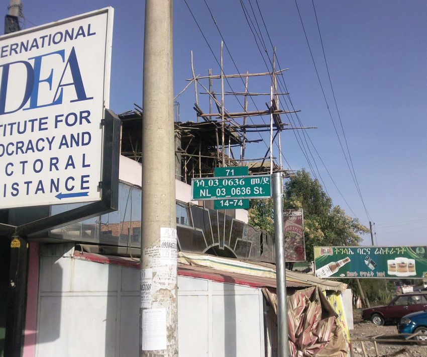
Neues Straßenschild mit neuer Straßennummer. // New street sign with new street number.
KATASTER, GRUNDBUCH UND
ADRESSEN FÜR ADDIS ABEBA
// CADASTRE, PROPERTY
REGISTER AND ADDRESS
SYSTEM FOR ADDIS ABABA
28 | gis.BUSINESS 7/2013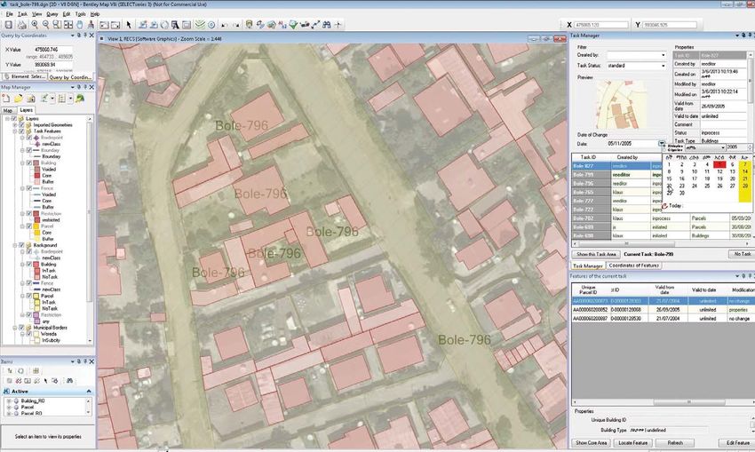
2009 wurde von der Stadt Addis Abeba ein // In 2009 a tender was put out by the city
Projekt zum Aufbau eines modernen Katas- of Addis Ababa, capital of Ethiopia, for the
ter-/Grundbuchsystems für die äthiopische development of a real property register and
Hauptstadt international ausgeschrieben. cadastre system. An address system, integra-
Gleichzeitig sollte die Stadt ein Adresssystem ted into the property register / cadastre, was
erhalten, das in das Kataster-/Grundbuch- included in the tender. Hansa Luftbild of Mu-
system zu integrieren war. Die Firma Hansa enster, Germany, a firm which is celebrating
Luftbild aus Münster, die in diesem Jahr Ihr its 90th anniversary this year, was awarded
90-jähriges Bestehen feiert, erhielt den Zu- the project. The firm developed an optimal
schlag und hat in den Folgejahren gemein- approach and implemented a system, on-
sam mit äthiopischen Experten die geforder- site, in co-operation with Ethiopian experts.
ten Systemlösungen realisiert und vor Ort The following describes this highly deman-
installiert. Ein Überblick. ding project.
N F
ach dem Sturz von Kaiser Haile Selassie im Jahre ollowing the 1974 fall of Ethiopia’s Emperor Haile Se-
1974 hat das Derg-Regime in Äthiopien die Mon- lassie, the new Derg regime disestablished the country’s
archie abgeschafft und den Sozialismus eingeführt, monarchy, formed a socialist state and nationalised all
wobei der gesamte Grund und Boden verstaatlicht wurde. SURSHUW\,Q
(WKLRSLDZDVSURFODLPHGD)HGHUDO'HPR-
Seit 1995 ist Äthiopien eine parlamentarische Bundesrepu- cratic Republic and since 1998 has consisted of nine indepen-
blik, seit 1998 gibt es neun eigenständige Regionen sowie dent regions, as well as two autonomous cities (Addis Aba-
zwei unabhängige Städte (Addis Abeba und Dire Dawa). Seit EDDQG'LUH'DZD ,QUHFHQWWLPHV(WKLRSLDKDVFDXWLRXVO\
einigen Jahren öffnet sich das Land vorsichtig der Marktwirt- opened itself up as a free market economy. Despite this, the
schaft. Allerdings ist eine Reprivatisierung des Bodens bisher government has no plans to re-privatise the ownership of land.
nicht beabsichtigt, der Staat verpachtet weiterhin das Land 7KHVWDWHFRQWLQXHVWROHDVHODQGIRUDGH¿QHGSHULRGRIWLPH
IUHLQHQGH¿QLHUWHQ=HLWUDXPDQ,QWHUHVVHQWHQYHUJOHLFKEDU This system is comparable with the German “Erbbaurecht”,
unserem Erbbaurecht. Dies gilt jedoch nicht für Gebäude, which awards the heritable right of erecting and maintaining
für die generell ein Eigentumsrecht besteht. Grundbesitz und a building (on another’s property). Buildings, however, as
Gebäudeeigentum sowie ihre Organisation durch Behörden opposed to land, are covered by private ownership laws. Pro-
werden durch eine unübersichtliche Vielzahl an Gesetzen und perty ownership, and the control of such by the authorities,
Verordnungen geregelt. Nach französischem Vorbild wurde is regulated through a multitude of non-transparent laws and
1960 ein Bürgerliches Gesetzbuch („Civil Code of the Empire edicts. The “Civil Code of the Empire of Ethiopia”, based on
of Ethiopia“) mit ausführlichen Regelungen zum Umgang mit a French model, and introduced in 1960 contains exhausti-
/DQG XQG *HElXGHQ HLQJHIKUW GLH ]ZDU RI¿]LHOO XQJOWLJ ve regulations with regard to the administration of property
sind, in der Praxis aber offenbar weiterhin bei Bedarf ange- DQG ODQG EXW LV QRW RI¿FLDOO\ VDQFWLRQHG 1HYHUWKHOHVV WKH-
wendet werden. Erschwert wird der Einstieg in diese Materie se regulations have been applied when the need arises. The
noch dadurch, dass aufgrund des Föderalismus in Äthiopien property system is further complicated by the federal system
viele Gesetze und Verordnungen durch die Regionen und un- since many laws and regulations developed and applied in the
abhängigen Städte entwickelt und angewendet werden, teil- independent regions or autonomous cities have been framed
weise unter Rücksichtnahme auf ethnische Besonderheiten. with particular consideration to the mores of local ethnic
Die Hauptstadt Addis Abeba ist Sitz der UN-Wirtschafts- communities.
kommission für Afrika und des Hauptquartiers der Afrika- Addis Ababa, headquarters of the African Union and the
nischen Union und hat damit eine zentrale Bedeutung für UN Economic Commission for Africa, is a highly important
Afrika mit einer Vielzahl an internationalen Konferenzen. city on the African continent, as evidenced by its serving as
Addis Abeba hat sich in den vergangenen 20 Jahren massiv a venue for many international conferences. Over the past
HQWZLFNHOWHLQHUVHLWVDOVZLFKWLJHVZLUWVFKDIWOLFKHV=HQWUXP 20 years Addis Ababa has expanded enormously, due to its
bWKLRSLHQVDQGHUHUVHLWVEHGLQJWGXUFKGLH/DQGÀXFKWGLHGLH increasing importance as an economic centre. Rural-urban
Bevölkerung auf rund vier Millionen Einwohner anwachsen migration has also contributed to the population growth,
ließ. Gegenwärtig bemüht sich die Stadt darum, die dabei ent- which now stands at approximately 4 million. The city ad-
standenen und über das Stadtgebiet verteilten Slums aufzulö- ministration is currently trying to clear the slums of Addis
sen und den Bewohnern alternativen Wohnraum überwiegend Ababa. Slum dwellers are being offered alternative housing,
am Stadtrand anzubieten. Dazu errichtet die Stadt Mehrfami- FRQVLVWLQJRIFRPPXQLW\DGPLQLVWHUHGRZQHURFFXSLHGÀDWV
lienhäuser, die als gemeinschaftlich verwaltete Eigentums- (condominiums) for purchase. These apartment buildings,
wohnungen („Condominiums“) zur Verfügung gestellt wer- FRQVWUXFWHGE\WKHFLW\DUHFKLHÀ\ORFDWHGLQWKHVXEXUEV7KH
den. Die positive wirtschaftliche Entwicklung der Stadt und rapid development of Addis Ababa as an economic hub and
ihr internationaler Status führen zu einer regen Bautätigkeit its increasing international status has also led to brisk cons-
|IIHQWOLFKHU XQG SULYDWHU ,QYHVWRUHQ$Q YLHOHQ 6WHOOHQ ZHU- truction activity amongst private and public investors. Many
den neue Hotels und Bürogebäude errichtet, die den ständig QHZKRWHOVDQGRI¿FHEXLOGLQJVDUHEHLQJSODQQHGWRPHHWWKH
gis.BUSINESS 7/2013 | 29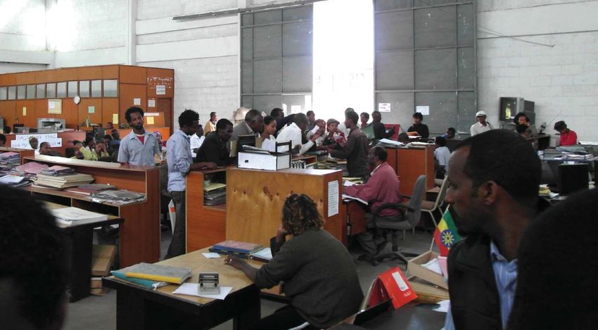
INNOVATION
ADDIS ABEBA // ADDIS ABABA
steigenden Bedarf abdecken sollen. Dazu werden vor allem die growing demand. These will largely be built in cleared slum
frei werdenden Slumgebiete im Stadtinneren genutzt, die durch areas, within the city centre; the cleared areas being acquired
GLH6WDGW]DKOXQJVNUlIWLJHQ,QYHVWRUHQEHUODVVHQZHUGHQ IURPWKHFLW\E\¿QDQFLDOO\SRZHUIXOLQYHVWRUV
Das massive Wachstum der Stadt, die rege Bautätigkeit Rapid urbanisation, construction booms, and slum re-
und die Umsiedlung der Slumbewohner erfordern umfangrei- settlement programmes necessitate effective urban and inf-
che Planungsmaßnahmen zur Gestaltung der Baugebiete und rastructure planning / development, which in turn require a
GHUVWlGWLVFKHQ,QIUDVWUXNWXU=XU)LQDQ]LHUXQJGHUGDPLWYHU- secure source of funding. Addis Ababa has one such source
bundenen Leistungen ist die Stadt auf gesicherte Einnahmen in its rent from land / fee charges paid by building owners
angewiesen. Wesentliche Einnahmequellen sind die Pachtzin- and businesses. The systematic levying of such requires the
sen von den Grundstücken und Abgaben der Gebäudeeigentü- establishment of a complete and reliable cadastre / property
PHUXQG*HZHUEHWUHLEHQGHQ,KUHNRQVHTXHQWH(UKHEXQJVHW]W registration system in which all parcels of land and buildings
ein vollständiges und zuverlässiges Kataster- /Grundbuchsys- and their owners as well as the data necessary for city admi-
tem voraus, in dem sämtliche Grundstücke und Gebäude mit nistration are documented.
ihren Besitzern und Eigentümern und den für die städtischen The last attempt to create a reliable cadastre for Addis
Aufgaben erforderlichen Daten nachgewiesen sind. Ababa took place in 1996. A multi-purpose cadastre was
Der letzte Versuch, ein verlässliches Kataster für Addis developed to support land valuation / taxation, to serve as a
Abeba aufzubauen, erfolgte im Jahre 1996. Es wurde ein basis for city planning, and to facilitate the issuance of title
Mehrzweckkataster aufgebaut, das die Grundstücksbewer- GHHGVDQGEXLOGLQJSHUPLWV,QDGHTXDWHRQJRLQJPDLQWHQDQFH
tung und Steuererhebung ermöglichen, als Grundlage für die of the cadastre led to its qualitative deterioration and rendered
städtische Planung dienen und die Erteilung von Besitzur- it unusable. Thus in 2009 the city called for tenders for the
kunden und Baugenehmigungen unterstützen sollte. Unzurei- renewal of its cadastre. The tender envisaged the project as a
chende Fortführungsverfahren führten zu einer Erosion des two phase process:
.DWDVWHUVGLHHVDOV*UXQGODJHXQEUDXFKEDUPDFKWH,P-DKUH Phase 1
2009 sah sich die Stadt deshalb genötigt, auf der Grundla- Z update cadastral map
ge einer internationalen Ausschreibung einen Neuaufbau des Z support establishment of municipal real property regis-
Katasters in Angriff zu nehmen. Die Ausschreibung sah eine WUDWLRQRI¿FHV
Realisierung des Projektes in zwei Phasen vor: Z UHTXLUHPHQWVDQDO\VLVGHVLJQDQGVSHFL¿FDWLRQRIUHDO
Phase 1 property registration and land information (cadastre)
Z Aktualisierung der existierenden Katasterkarte, systems
Z Unterstützung beim Aufbau der Grundbuch- und Kata- Z development of address system.
sterbehörden, Phase 2
Z Bedarfsanalyse, Konzeption des digitalen Kataster- / Z development and implementation of real property
Grundbuchsystems, registration and land information (cadastre) systems
Z Entwicklung eines Adresssystems. Z support for establishment of municipal real property
Phase 2 UHJLVWUDWLRQRI¿FHV
Z (QWZLFNOXQJXQG,PSOHPHQWLHUXQJGHV.DWDVWHU The tender was awarded to Hansa Lufbild of Muenster,
Grundbuchsystems Germany. At the suggestion of Hansa Luftbild Addis Ababa
Z Unterstützung bei der Einrichtung der Kataster- und city set up separate specialist working groups, each of which
Grundbuchbehörden. supported the project with expert knowledge and advice in
'HU=XVFKODJZXUGHGHU)LUPD+DQVD/XIWELOGDXV0QV- WKHLUUHVSHFWLYH¿HOGV7KLVHQVXUHGWKDWFRPSHWHQWDVVLVWDQFH
ter erteilt. Auf Anregung von Hansa Luftbild richtete die Stadt was always available on-site. Responsibility for the entire
Abb. 1: Strukturbild der Informationssysteme AA-CADIS und AA-LIS // Abb. 2: Organisatorische Einbindung von AA-CADIS // Figure 2:
Figure 1: Structure of AA-CADIS und AA-LIS Relationship of AA-CADIS to city agencies / authorities
30 | gis.BUSINESS 7/2013
Innerhalb des ehemaligen Grundbuchamts. // Inside old property registration office.
fachliche Arbeitsgruppen ein, die das Projekt in den verschiede- SURMHFWZDVXQGHUWDNHQE\WKH,QWHJUDWHG/DQG0DQDJHPHQW
nen Aufgabenfeldern mit ihrem sachkundigen Rat begleiteten ,QIRUPDWLRQ 6\VWHP 3URMHFW &RRUGLQDWLRQ 2I¿FH ,/0,63-
und für eine nachhaltige Sicherung des Projekt-Know-hows vor CO) on behalf of the city administration. Hansa Luftbild was
Ort sorgten. Die Gesamtverantwortung für die Durchführung UHTXLUHGWRUHSRUWWR,/0,63&2$GHFLVLYHIDFWRULQWKHVXF-
GHV3URMHNWVEHUQDKPIUGLH6WDGWYHUZDOWXQJGDVÄ,QWHJUDWHG cess of the project was the constructive working relationship
/DQG 0DQDJHPHQW ,QIRUPDWLRQ 6\VWHP 3URMHFW &RRUGLQDWLRQ HVWDEOLVKHG ZLWK WKH ZRUNLQJ JURXSV DQG ,/0,63&27KHLU
2I¿FH ,/0,63&2 ³GHPJHJHQEHU+DQVD/XIWELOGEHULFKWV- active co-operation ensured that sound decisions were taken
SÀLFKWLJZDU0LWHQWVFKHLGHQGIUGHQ(UIROJGHV3URMHNWVZDU and Ethiopian cultural norms observed. A further factor in the
GLHNRQVWUXNWLYHXQGYHUWUDXHQVYROOH=XVDPPHQDUEHLWPLW,/- project’s success was that it was entirely funded by the city
0,63&2 XQG GHQ 0LWJOLHGHUQ GHU$UEHLWVJUXSSHQ GLH GXUFK itself. This increased the commitment of the city functionaries
ihre aktive Mitwirkung dafür sorgten, dass Fehlentwicklungen to the project’s success.
vermieden und die kulturellen Besonderheiten in Äthiopien be-
rücksichtigt wurden. Mitentscheidend war aber auch, dass das INITIAL SITUATION
Projekt vollständig aus Eigenmitteln der Stadt ohne externe
)|UGHUXQJ¿QDQ]LHUWZXUGHZDVGDVYLWDOH,QWHUHVVHGHUYHUDQW- ,QDQDO\VLQJWKHRULJLQDOFDGDVWUH+DQVD/XIWELOGHVWDEOLVKHGWKDW
wortlichen städtischen Politiker an einem Erfolg des Projekts Z 1. The available digital cadastre maps consisted of
zur Folge hatte. parcels of land and buildings extracted from a 1996
topographic map. The digital maps did not cover the
AUSGANGSSITUATION entire city and had never been updated. The parcels
and buildings were inconsistently numbered, and could
Bei der Analyse der Ausgangssituation fand Hansa Luftbild not be reliably linked to their descriptive data.
IROJHQGHQ=XVWDQGYRU
Z 2. An address system developed with the assistance of
Z 1. Die vorhandene digitale Katasterkarte war ein Aus- a German expert never got beyond the initial stages
zug von Parzellen und Gebäuden aus einer topographi- and was only implemented for a minimal number of
schen Karte von 1996. Sie deckte nicht das gesamte streets. Consequently the system was unusable.
Stadtgebiet ab und war seitdem nicht fortgeführt. Par- Z 3. For each of the ten sub-cities the register of real pro-
zellen und Gebäude waren uneinheitlich nummeriert, perty consisted of six handwritten registers, so-called
die Verknüpfungen mit den beschreibenden Daten “Big Books”. A close examination of these revealed
waren unzuverlässig. that much of the “Big Books” information was redun-
Z 2. Ein mithilfe eines deutschen Experten entwickeltes dant and / or inaccurate.
Adresssystem war in den Ansätzen steckengeblieben, Z 4. The legislative basis for the operation and use of the
praktisch nur für wenige Straßen umgesetzt und damit property register and cadastre was non-transparent and
unbrauchbar. incomplete.
gis.BUSINESS 7/2013 | 31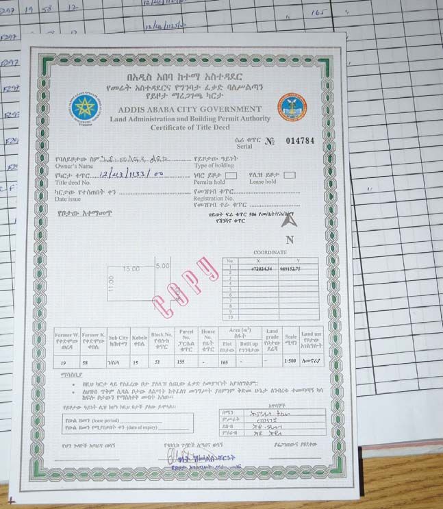
INNOVATION
ADDIS ABEBA // ADDIS ABABA
Z 3. Die Registrierung der Buchdaten erfolgte in sechs REQUIREMENTS ANALYSIS
handgeschriebenen sogenannten „Big Books“, unab-
hängig in den zehn Stadtbezirken. Bei der Untersu- A thorough needs analysis with concrete solutions was prepa-
FKXQJVWHOOWHVLFKKHUDXVGDVVYLHOH,QIRUPDWLRQHQ red by Hansa Luftbild on the basis of the requirements outli-
redundant abgelegt und fehlerhaft waren. ned in the tender document. The needs analysis consisted of
Z 4. Die Rechtsgrundlagen für den Umgang mit Grund- several fundamental constituents. Firstly all business proces-
buch- und Katasterdaten waren unübersichtlich und ses involved in gathering property registration and cadastral
unvollständig. data were formulated as “use cases’ and modelled as busi-
ness processes. Secondly all required products were derived
BEDARFSANALYSE IURPWKHVHSURFHVVHVDQGFRQ¿JXUHGLQDQDSSURSULDWHZD\
Finally the services to be provided by these products were
$XI GHU *UXQGODJH GHU LQ GHU $XVVFKUHLEXQJ GH¿QLHUWHQ fully described in accordance with the requirements of private
Anforderungen und der Analyse der Ausgangssituation er- and public users / clients. These various constituents were all
stellte Hansa Luftbild eine ausführliche Bedarfsanalyse mit based on a differentiated analysis of the current regulations,
konkreten Vorschlägen für die Gestaltung der neuen Syste- property register and business processes.
me. Wesentliche Bestandteile der Bedarfsanalyse waren die Hansa Luftbild suggested an approach based on a combi-
Modellierung aller Geschäftsprozesse zur Registrierung der nation of a property register / cadastre system (Addis Ababa
Grundbuch- und Katasterdaten und ihre formale Formulie- &DGDVWUH ,QIRUPDWLRQ 6\VWHP $$&$',6 DQG D ODQG DG-
rung als „Use Cases“, die Gestaltung und Ableitung der er- PLQLVWUDWLRQV\VWHP $GGLV$EDED/DQG,QIRUPDWLRQ6\VWHP
forderlichen Produkte und die Beschreibung der Dienste zur $$/,6 )LJXUH 7KHODWWHU $$/,6 LVDQGZDVWREH
Bereitstellung der Produkte entsprechend den Bedürfnissen UHJXODUO\XSGDWHGIURPWKH$$&$',67KHSODWIRUPRI$$
der öffentlichen und privaten Nutzer. Dies geschah auf der &$',6 FRQVLVWV RI D FRPPRQ FDGDVWUDO GDWDEDVH &&'%
Grundlage einer differenzierten Analyse der bestehenden which in turn is composed of the real property registration
Vorschriften, Register und Arbeitsverfahren. (RPRS) database and the real estate cadastre (RECS) databa-
Als Systemlösung hat Hansa Luftbild eine Kombinati- se, both of which share a common data model. The data mo-
RQ DXV HLQHP ,QIRUPDWLRQVV\VWHP IU GDV 0DQDJHPHQW YRQ GHOLVEDVHGRQWKH,627&VWDQGDUG1RUP
³/DQG
*UXQGEXFK XQG .DWDVWHU $$&$',6 XQG HLQHP ,QIRUPD- Administration Domain Model (LADM)”. A distributed solu-
tionssystem zur Unterstützung der verschiedenen städtischen tion was necessary, which entailed a central system and sys-
$QZHQGXQJHQ $$/,6 YRUJHVFKODJHQ $EE GDVUHJHO- WHPVIRUHDFKRIWKHWHQVXEFLWLHV$$/,6LVLQWHUIDFHGYLD
PlLJGXUFK$$&$',6DNWXDOLVLHUWZLUG*UXQGEXFK 5HDO Open Geospatial Consortium (OGC) standardised services,
Property Registration System – RPRS) und Kataster (Real through which public and private users are given access to the
Estate Cadastre System – RECS) folgen einem gemeinsamen property register and cadastre.
Datenmodell und werden integriert als „Common Cadastre )LJXUHLOOXVWUDWHVWKHUHODWLRQVKLSRI$$&$',6WRWKH
Database - CCDB“ geführt. Das Datenmodell basiert auf der city agencies and administrative authorities. The newly for-
,627&1RUP
Ä/DQG$GPLQLVWUDWLRQ'RPDLQ0R- PHGDXWKRULW\WKH,PPRYDEOH3URSHUW\5HJLVWUDWLRQDQG,Q-
del – LADM“. Für Addis Abeba wurde eine verteilte Lösung IRUPDWLRQ$JHQF\ ,35,$ LV IXOO\ UHVSRQVLEOH IRU WKH SUR-
erforderlich, mit einem zentralen System und zehn Subsyste- perty register and cadastre and works closely with all the land
PHQLQGHQ]HKQ6WDGWEH]LUNHQ$$/,6VWHOOWHLQ1XW]HULQ- authorities / agencies which appear in Figure 2.
terface bereit, über das die privaten und öffentlichen Nutzer
EHU VWDQGDUGLVLHUWH 2*&:HE'LHQVWH GHQ =XJULII DXI GLH UPDATE OF CADASTRAL MAP DATA
Grundbuch- und Katasterdaten erhalten.
'LH RUJDQLVDWRULVFKH (LQELQGXQJ YRQ$$&$',6 LQ GLH Three steps were required in order to update the cadastral
Behördenstruktur von Addis Abeba zeigt die Abb. 2. Verant- maps
wortlich für die Führung von Grundbuch und Kataster wird Z ,GHQWLI\GDWDJDSVDVVHVVTXDOLW\RIFXUUHQWFDGDVWUDO
GLH QHX JHVFKDIIHQH %HK|UGH Ä,PPRYDEOH 3URSHUW\ 5HJLVW- maps, produce updated cadastral map
UDWLRQDQG,QIRUPDWLRQ$JHQF\±,35,$³6LHVWHKWLQHQJHU Z 2. Verify quality of existing ground control points
Beziehung zu den übrigen in der Abb. genannten Behörden Z 'HYHORSDXQL¿HGLGHQWL¿FDWLRQV\VWHP
des Landsektors. ,QFRPSDULQJRUWKRSKRWRVIURPWKH\HDUZLWK
the existing cadastre maps it was established that 60% of the
AKTUALISIERUNG DER KATASTERKARTE area of Addis Ababa was covered. Fifty-eight point two per
cent (58.2 %) of the city area required new data capture, and
=XU$NWXDOLVLHUXQJGHU.DWDVWHUNDUWHZDUHQGUHL6FKULWWHHU- 41.8% of the mapped data needed to be updated (Figure 3). A
forderlich: comparison of aerial photos acquired in 2010 with the exis-
Z 1. Ermittlung der Datenlücken, Feststellung der Qua- ting cadastre data gave further information about the geome-
lität der bestehenden Katasterkarte, Produktion einer tric quality of the data.
aktualisierten Katasterkarte The red arrow shows a contradiction between the bound-
Z 9HUL¿]LHUXQJGHU4XDOLWlWGHVEHVWHKHQGHQ3DVV- aries indicated by the cadastre data and the actual boundary.
punktfeldes The blue arrow shows a case in which the map accurately
Z (QWZLFNOXQJHLQHVHLQKHLWOLFKHQ,GHQWL¿NDWLRQVV\V- depicts the locality. Such cases were checked using photo-
tems JUDPPHWULFUHVWLWXWLRQDQGZKHUHDSSOLFDEOHFRQ¿UPHGDVDF-
Beim Vergleich der vorhandenen Orthophotos aus den curate. Data from the 2010 aerial survey and the subsequently
32 | gis.BUSINESS 7/2013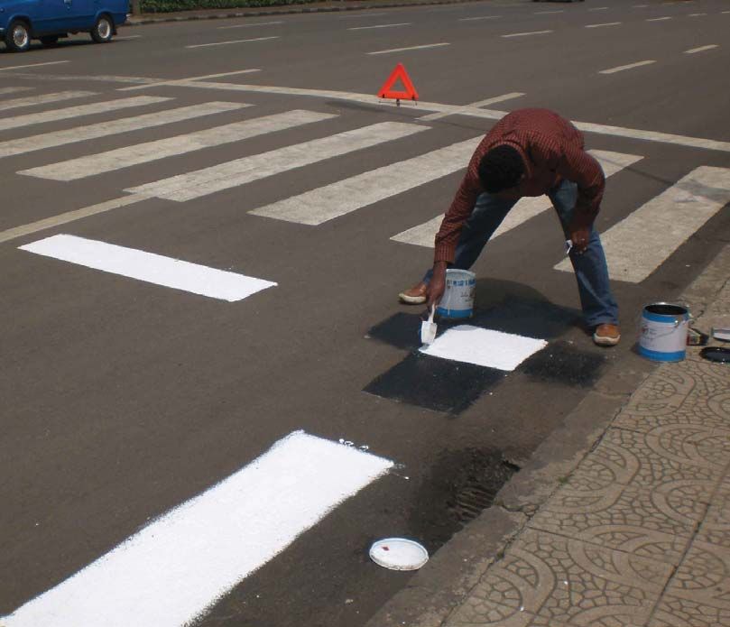
Abb. 3: Überlagerung der bestehenden Katasterdaten mit einem Orthophoto von 2005/2006.
// Figure 3: Cadastral data superimposed on a 2005/2006 orthophoto.
Jahren 2005/2006 mit der bestehenden Katasterkarte stellte FDSWXUHG GDWD ZDV XVHG DV D EDVH WR GLJLWLVH DOO LGHQWL¿DEOH
sich heraus, dass nur 60 Prozent der Fläche von Addis Abeba parcels, buildings and street networks as polygons and input
DEJHGHFNWZDUHQGDVVIU3UR]HQWGHU6WDGWÀlFKHHLQH WKHPLQWRD
*,6GDWDEDVH$WWKHVDPHWLPHHDFKRE-
Neuerfassung und für 41,8 Prozent eine Aktualisierung erfor- MHFW ZDV JLYHQ D XQLTXH LGHQWL¿HU DQG KDG LQLWLDO DWWULEXWHV
derlich war. Der Vergleich von Orthophotos aus einer Neu- added to it.
EHÀLHJXQJLP-DKUHPLWGHQ.DWDVWHUGDWHQJDEZHLWHUH $¿HOGFKHFNRIWKHJURXQGFRQWUROSRLQWVLQ-XQHUH-
Hinweise auf die geometrische Qualität der Daten, wie Abb. vealed that of the 150 available points 31 had been destroyed
3 zu entnehmen ist. or were inaccessible. Sixty-two additional ground control
Der rote Pfeil zeigt einen Widerspruch zwischen der in points were required and surveyed to achieve adequate co-
der Katasterkarte dargestellten Grenze mit der tatsächlichen YHUDJHIRUEORFNDGMXVWPHQW,QDQDO\VLQJWKHJURXQGFRQWURO
Situation. Fehler dieser Art wurden durch Änderung der Ka- SRLQWVLWEHFDPHFOHDUWKDWWKHLUTXDOLW\ZDVLQVXI¿FLHQWIRUD
tasterkarte behoben. Der blaue Pfeil zeigt eine Situation, in cadastre survey. Hansa Luftbild therefore recommended that
der Karte und Örtlichkeit gut übereinstimmen. Solche Fälle either an active GPS reference network be established for Ad-
wurden durch stereophotogrammetrische Auswertung über- dis Ababa, or that the density of point coverage be increased
prüft und gegebenenfalls bestätigt. Auf der Grundlage der to one point per square kilometre with accuracy of 5 cm or
%HÀLHJXQJ YRQ XQG DQVFKOLHHQGHU VWHUHRSKRWRJUDP- better.
metrischer Auswertung wurden alle erkennbaren Parzellen Finally at the suggestion of Hansa Luftbild, and on the ba-
und Gebäude sowie das gesamte Straßennetz digital erfasst VLVRIDPRGHOFRPPRQO\XVHGLQ*HUPDQ\WKHLGHQWL¿FDWLRQ
XQGDOV3RO\JRQHLQHLQHP*,6HQWVSUHFKHQGHLQHP.DUWHQ- system for cadastre objects was designed to be independent of
gis.BUSINESS 7/2013 | 33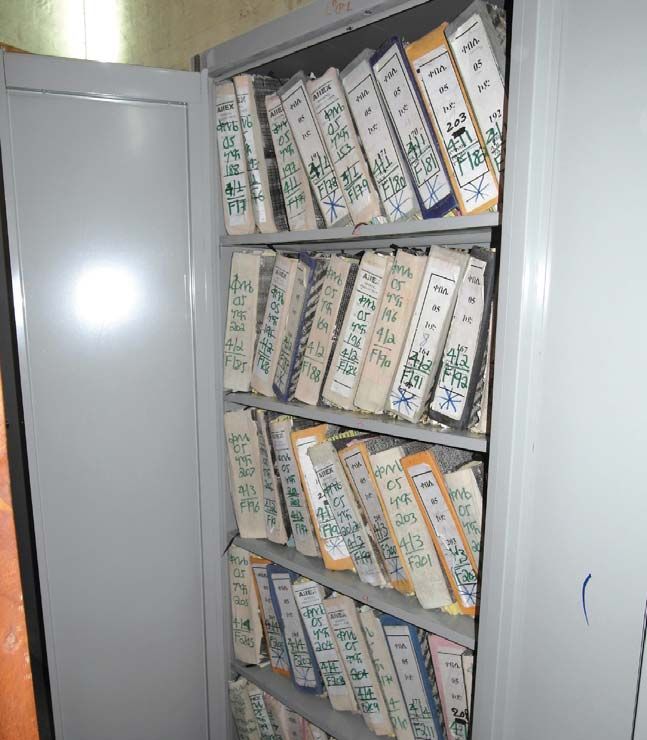
INNOVATION
ADDIS ABEBA // ADDIS ABABA
Abb. 4: Organisationsstruktur der Zentrale von IPRIA. // Figure 4:
Organisational structure of IPRIA head office.
maßstab 1:2.000 abgelegt. Gleichzeitig wurden die Objekte the city’s administrative structure.
HLQGHXWLJEHUHLQ,GHQWL¿NDWLRQVV\VWHPJHNHQQ]HLFKQHWXQG Setting-up of address system
mit ersten Attributen versehen. Since an address system based on street names and house
Bei der Überprüfung des vorhandenen Passpunktfeldes numbers, as conceptualised by a German expert, had stalled
stellte sich heraus, dass von den 150 vorhandenen Punkten in its initial stages, it was crucial that an address system be
31 zerstört oder nicht erreichbar waren und dass 62 zusätz- set up concurrent with the cadastre development. The wor-
liche Passpunkte benötigt wurden, um eine für die Block- king group, responsible for the address system, developed a
ausgleichung hinreichende Punktverteilung zu erreichen. solution based on a World Bank concept described in “Street
Die Einmessung erfolgte im Juni 2010. Bei der Analyse des Addressing and the Management of Cities”. The concept has
Passpunktfeldes wurde deutlich, dass die Qualität der vor- been applied successfully in many countries, including Afri-
handenen Punkte für Katastermessungen nicht ausreichte. ca. Once the city administration had concurred with the con-
Hansa Luftbild hat deshalb empfohlen, entweder ein aktives cept, a permanent “Street Addressing Unit”, consisting in the
GPS-Referenznetz für Addis Abeba zu realisieren oder die main of members from the working group, was established.
Punktfelder so weit zu verdichten, dass pro Quadratkilometer The successfully implemented solution discarded street na-
HLQ 3XQNW PLW HLQHU *HQDXLJNHLW YRQ IQI =HQWLPHWHUQ RGHU mes in favour of street numbers, to avoid drawn-out political
besser entsteht. discussions.
Schließlich wurde auf Empfehlung von Hansa Luftbild
HLQ ,GHQWL¿NDWLRQVV\VWHP IU .DWDVWHUREMHNWH XQDEKlQJLJ SUPPORT FOR ESTABLISHMENT OF REAL
von der Verwaltungsgliederung nach deutschem Vorbild PROPERTY REGISTRATION OFFICES
eingeführt.
Grundbucharchiv in einem Stadtbezirk. // Previous tenure archive Kopie einer Eigentumsurkunde (ehemals). // Copy of a previous title
in a sub-city. deed.
34 | gis.BUSINESS 7/2013
EINRICHTUNG EINES                                                A substantial problem in managing real property registration
ADRESSSYSTEMS                                                    in Addis Ababa had been that areas of responsibility were not
                                                                 clearly delineated as to the use and maintenance of the real
Nachdem ein Versuch zum Aufbau eines modernen Adress-            property register. The ten sub-cities were not subject to tight-
systems auf der Basis von Straßennamen und Hausnummern,          O\FRQWUROOHGVWDQGDUGLVHGSUDFWLFHVE\WKHFHQWUDODXWKRULW\,Q
das von einem deutschen Experten konzipiert worden war, in       WKHFLW\HVWDEOLVKHGE\ODZWKH,35,$FRQVLVWLQJRIDFHQ-
GHQ$QIlQJHQVWHFNHQJHEOLHEHQZDUVROOWHQXQPHKULP=X-         WUDODJHQF\DQGWHQVXEFLW\EUDQFKRI¿FHV7KHRUJDQLVDWLRQDO
sammenhang mit dem Katasteraufbau ein solches System mit         VWUXFWXUH RI ,35,$¶V KHDG RI¿FH DV DQDO\VHG DFFRUGLQJ WR LWV
Unterstützung von Hansa Luftbild endgültig realisiert wer-       business processes is represented by the following schema:
den. Die dazu eingerichtete Arbeitsgruppe entwickelte einen           7KHVXEFLW\RI¿FHVZKLFKDUHUHODWLYHO\ÀDWLQVWUXFWXUHDUH
Lösungsansatz auf der Grundlage eines durch die Weltbank         FKLHÀ\FRQFHUQHGZLWKFXVWRPHUVHUYLFHDQGGD\WRGD\RSHUD-
in der Publikation „Street Addressing and the Management         WLRQV$FFRPPRGDWLRQIRUWKHVXEFLW\RI¿FHVZDVFRQVWUXFWHG
of Cities“ veröffentlichten Konzepts, das bereits mehrfach er-   during the project development phase. Each new building was
folgreich unter anderem auch in afrikanischen Ländern umge-      designed to accommodate around 100 employees (per sub-city)
VHW]WZRUGHQZDU1DFK=XVWLPPXQJGHU6WDGWYHUZDOWXQJ]X        and equipped with all the necessary network infrastructure.
dem Konzept wurde eine ständige „Street Addressing Unit“              While the administrative and business structures were
bei der Stadt eingerichtet, bestehend im Wesentlichen aus        HDVLO\ FODUL¿HG WKH FRQ¿JXUDWLRQ RI WKH DGMXGLFDWLRQ SUR-
Mitgliedern der Arbeitsgruppe. Das Konzept wird gegenwär-        cess required extensive discussion. Adjudication the process
tig erfolgreich umgesetzt, indem man zunächst auf Straßen-       whereby parcel ownership is established is to be undertaken
namen zugunsten von Straßennummern verzichtet, um lang-          systematically for the entire area of Addis Ababa. Originally
wierigen politischen Diskussionen aus dem Wege zu gehen.         envisaged as the work of an independent business unit, the
                                                                 SURFHVVZDVDVVLJQHGWRWKH,35,$VLQFHWKHEXVLQHVVSURFHV-
UNTERSTÜTZUNG BEIM AUFBAU VON                                    ses entailed are practically identical to regular updating of the
KATASTER- UND GRUNDBUCHBEHÖRDEN                                  property register and cadastre.

Als wesentliches Problem bei der Führung von Grundbuch           SYSTEM DEVELOPMENT
XQG.DWDVWHULQ$GGLV$EHEDKDWWHVLFKGLHXQNODUH=XVWlQ-       AND IMPLEMENTATION
digkeit für die Führung und Nutzung der Register und die
fehlende straffe zentrale Kontrolle über die dezentral bei den   Originally a completely online approach was planned but

                                                                                                                              gis.BUSINESS 7/2013 |   35
INNOVATION
  ADDIS ABEBA // ADDIS ABABA

                Abb. 5: Verwaltung von Eigentumsrechten in RPRS. // Figure 5: Administration of property ownership in RPRS.

                Abb. 6: RECS Benutzerschnittstelle. // Figure 6: RECS user interface.

                Subcities (Stadtbezirken) eingerichteten Grundbuch- und Ka-             this was not implemented due to weaknesses in the city te-
                tasterbehörden nach einheitlichen Standards herausgestellt.             lecommunications network. The solution implemented al-
                'LH 6WDGW KDW GHVKDOE EHUHLWV LP -DKUH  ,35,$ PLW HL-     lows customer service to continue, even when the network
                QHUVWDUNHQ=HQWUDOEHK|UGHXQG=ZHLJQLHGHUODVVXQJHQLQGHQ             is down and / or communication is disrupted between the
                zehn Subcities per Gesetz eingerichtet. Die Organisations-              FHQWUDO RI¿FH DQG D VXERI¿FH 7KLV LV DFKLHYHG WKURXJK
                VWUXNWXUYRQ,35,$LP+DXSWTXDUWLHUZXUGHQDFKGHU$QDO\VH             the use of a proxy database and OGC services in each of
                der Geschäftsprozesse nach folgendem Schema festgelegt:                 the ten sub-cities. The centralised and decentralised da-
                    Eine vereinfachte Struktur weisen die Büros in den Sub-             tabases of the system are managed by Oracle and Oracle
                cities auf, weil sie keine zentralen Funktionen zu übernehmen           Locator.

36 | gis.BUSINESS 7/2013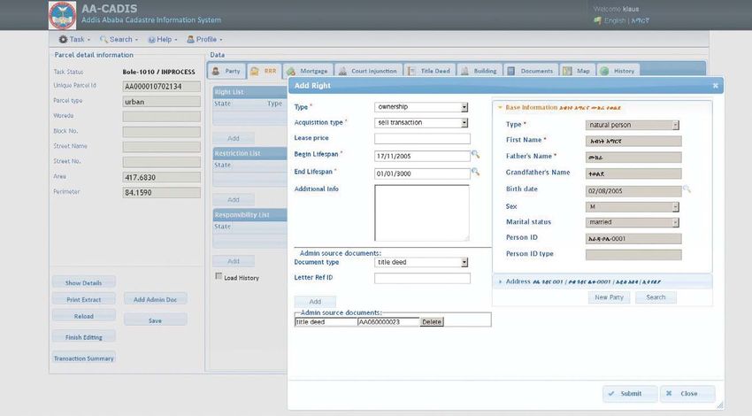
haben. Dafür stehen die Kundenbetreuung und das operative
Geschäft im Vordergrund. Während der Projektlaufzeit wur-
den für die Subcities neue Gebäude für je rund 100 Mitarbei-
ter und für die benötigte Technik errichtet.
Während die übrige Struktur schnell geklärt werden
NRQQWHEHQ|WLJWHGLH=XRUGQXQJGHU$XIJDEHÄ$GMXGLFDWLRQ³
längere Diskussionen. Unter Adjudication wird die endgül-
WLJH UHFKWOLFKH =XRUGQXQJ HLQHU 3DU]HOOH ]X LKUHP %HVLW]HU
verstanden, die Addis Abeba systematisch für das gesamte
Stadtgebiet vornehmen will. Nachdem zunächst die Einrich-
tung einer eigenen organisatorischen Einheit für diese Auf-
gabe geplant war, hat man sie dann doch als Teilaufgabe von
,35,$IHVWJHOHJWZHLOGLHDXV]XIKUHQGHQ*HVFKlIWVSUR]HVVH
nahezu identisch mit den regulären Fortführungsprozessen
von Grundbuch und Kataster sind.
SYSTEMENTWICKLUNG UND -EINRICHTUNG
Ursprünglich war eine komplette Online-Lösung geplant,
dies war jedoch aufgrund der schwach vorhandenen Tele-
kommunikations- und Netzwerkinfrastruktur nicht möglich.
Die implementierte Lösung ermöglicht auch bei schwacher
RGHU QLFKW YRUKDQGHQHU 1HW]YHUELQGXQJ ]ZLVFKHQ =HQWUDOH Signalisieren eines der 62 Passpunkte vor dem Bildflug. // Marking
und Subcity eine Aufrechterhaltung des Kundenservice in den one of 62 ground control points prior to aerial photography.
Subcities. Erreicht wurde dies durch den Einsatz von Proxy-
Datenbanken und OGC-Diensten in den Subcities. Als zen- The cadastre component consists of RECS and is im-
trale und dezentrale Datenhaltungskomponente wird durch- plemented on the basis of Bentley Map. Bentley Map was
gehend Oracle mit Oracle Locator eingesetzt. selected because its topology and extensive geometric con-
Die Katasterkomponente RECS wurde auf Basis von struction methods provide a good basis for graphic cadastre.
Bentley Map implementiert. Bentley Map wurde gewählt, The RPRS-Client is a web application which can be invoked
da die Topologie und die umfangreichen geometrischen through a local application server in each sub-city and in
Konstruktionsmethoden eine gute Basis für ein graphisches FHQWUDORI¿FH$OOGDWDLQ5356DQG5(&6FDQEHDFFHVVHG
Kataster darstellen. Der RPRS-Client ist eine Web-Anwen- through OGC services. The replication of central city data in
dung und wird von einem lokalen Applikationsserver in the ten sub-cities is managed by a Hansa Luftbild software
MHGHU GHU ]HKQ 6XEFLWLHV XQG LQ GHU =HQWUDOH DXIJHUXIHQ DSSOLFDWLRQ GHYHORSHG WR PHHW WKH VSHFL¿F UHTXLUHPHQWV RI
hEHUGLH2*&'LHQVWHLVWHLQ=XJULIIDXIVlPWOLFKH'DWHQ- the Addis Ababa system.
bestände in RPRS und RECS möglich. Die Replikation der The cadastre of the central CCDB is not updated in real
'DWHQYRQGHU=HQWUDOH]XGHQ6XEFLWLHVZLUGPLWYRQGHU WLPH%DWFKXSGDWHVDUHLQYRNHGE\WKHVXEFLW\RI¿FHV(DFK
Hansa Luftbild speziell entwickelten Tools durchgeführt, update contains all information required for a transaction, eg
die auf die speziellen Bedürfnisse in Addis Abeba abge- parcel partitioning or changes in ownership structure. The
stimmt sind. jobs are generated as XMLs through the RPRS and RECS
Aktualisierungen des Katasters werden nicht direkt auf FOLHQWVDQGGHOLYHUHGWRWKHFHQWUDOFLW\RI¿FHHLWKHURQRU
GHU ]HQWUDOHQ &&'% VRQGHUQ GXUFK 'DWHQSÀHJHMREV GXUFK- off-line, for the updating of the CCDB.
geführt, die in den Subcities erzeugt werden. Solche Jobs 7KH$$&$',6DQG$$/,6ZHUHLQVWDOOHGRQPRUHWKDQ
HQWKDOWHQ DOOH QRWZHQGLJHQ ,QIRUPDWLRQHQ IU HLQH7UDQVDN- 35 Dell servers and on 23 Dell workstations, all of which
tion; Beispiel einer Transaktion ist z. B. eine Parzellenteilung were supplied by Hansa Luftbild.
oder Änderung des Eigentumsverhältnisses. Die Jobs werden Figures 5 and 6 illustrate examples of RPRS and RECS.W
durch die RPRS und RECS Clients als XMLs generiert und
EHU 1HW]ZHUNYHUELQGXQJHQ EHUWUDJHQ RGHU RIÀLQH DQ GLH
=HQWUDOHJHOLHIHUWZRGLH&&'%DNWXDOLVLHUWZLUG
'LH$$&$',6XQG$$/,66\VWHPHZXUGHQDXIPHKU
als 35 DELL Server und 23 DELL Workstations, die von der Autoren // Authors
Hansa Luftbild auch geliefert wurden, installiert. Heinz Brüggemann, Christian Timm und Tarek Zein
Die Abbildungen 5 und 6 zeigen Beispiele für RPRS und
RECS. W Hansa Luftbild AG Nevinghoff 20, 48147 Münster, Deutschland // Germany
T: +49 251 2330-132
F: +49 251 2330-112
E: brueggemann-heinz@t-online.de
E: timm@hansaluftbild.de
E: zein@hansaluftbild.de
W: www.hansaluftbild.de
gis.BUSINESS 7/2013 | 37Sie können auch lesen